We love hiking through nature. There’s no other activity that allows us to let our minds wander like hiking. Fortunately, there were plenty of opportunities for us during our tour through Slovakia. We started with the Mala Fatra National Park in the westernmost Slovakian high mountains. Here, we wanted to breathe in the first mountain air and get in the mood for the next two weeks. In this article, you’ll find out exactly what we experienced there, where this national park is located, and what else there is to do.
This might also interest you:
- Best time to travel to Slovakia
- Our Kosice Highlights
- Round trip through Slovakia
- Hiking in the Slovak Paradise
- Slovakia Sights
- The mountain lake Strbske Pleso
- Bratislava Highlights & Tips
- Costs of our Slovakia trip
- Low Tatras National Park
- Other countries in Europe
- This might also interest you:
- Mala Fatra National Park
- The Vràtna-Chleb cable car
- Hiking on the ridge path
- The way down
- Hiking to Veľký Rozsutec
- Getting to Mala Fatra National Park
- Accommodations in the region
- Other highlights in the area
- Conclusion Mala Fatra National Park Fatra
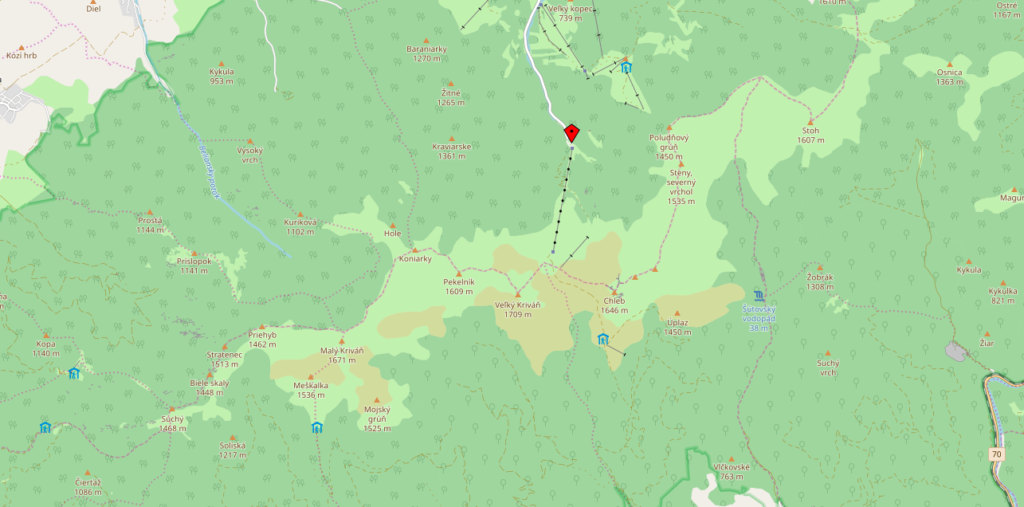
Mala Fatra National Park
The Little Fatra National Park is located in the western highlands of Slovakia. This truly pristine hiking area is often overshadowed by the High and Low Tatras, but it also boasts beautiful viewpoints, varied hiking trails, gorges, ravines, and rocky peaks. Bears, wolves, and lynx are even said to live here. Of course, you hardly ever see these forest dwellers.

The many secluded hiking trails lead you through enchanting mountain landscapes. For us, the Mala Fatra is definitely one of the most beautiful areas in Slovakia. Very popular are the ridge hike, a visit to the Sutovsky Waterfall and hikes to the peaks of the Little Fatra: Malý Rozsutec, Veľký Rozsutec and Veľký Kriváň.
The Vràtna-Chleb cable car
Good starting points for a hike are the towns of Terchová, Vrátna and Štefanová. We drove through Terchová and continued to the Vratna-Chleb cable car station. From there, we took the cable car up to Snilovské Sedlo. There’s a restaurant, restrooms, and a lovely visitor’s terrace. A ride up costs €10, a round trip €11.50, and if you only want to go down, you pay €9.

The cable car only runs once an hour between 9:00 a.m. and 4:00/4:30 p.m. outside of peak season. From June to September, the cable car also runs from 8:30 a.m. to 6:00 p.m. on certain days. It’s best to check this page in advance: Vrátna-Chleb cable car opening times. Luckily, we arrived just before noon, so we didn’t have to wait long for the next ride. We were at the top in just a few minutes.
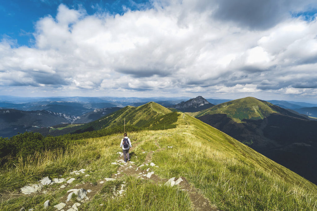
Hiking on the Ridge Trail
From the cable car station, we hiked along the red trail to Chleb and then on to Hromové. The hike is relatively easy; we don’t think it requires any particular fitness. However, you should at least have a certain level of stamina. The views of the valley, over the ridge, and across the mountains are truly spectacular. Luckily, we had really good weather, which made the landscapes look even more colorful.
On this hiking trail, you can also hike further to the 1,608-meter-high Stoh peak and further to the mighty Veľký Rozsutec peak. However, you should be in good shape and, above all, have time. Take a look at this hiking map. There you’ll find a variety of options.

If you take the cable car up, you can also start in the other direction. Then you have the opportunity to climb the highest peak in the Little Fatra, the 1709-meter-high Veľký Kriváň. This hike takes about an hour from the station. The last section is relatively steep and strenuous. In general, there are numerous hiking options in this area. Get a hiking map in advance in one of the towns or from the cable cars and choose a route that suits you.
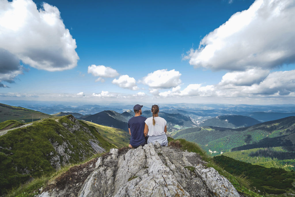
Our hike took a total of 4.5 hours. We climbed almost 1000 meters in altitude. The main ridge hike is highly recommended and also very beautiful. We would have liked to hike from the bottom to the top and take the cable car back down. Unfortunately, we didn’t have enough time, so we did this tour the other way around. Of course, you can always hike up and back down.
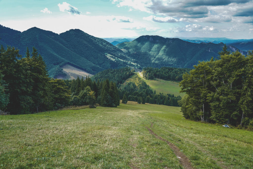
The Way Down
After hiking across the main ridge, we reached the last important intersection at an altitude of 1,460 meters. From there, the descent was quite steep. This was very strenuous for the feet and knees. The path led 500 meters directly down a steep ski slope. After about 45 minutes, we reached the Poludnovy Chata (hut) at 970 meters. From there, a path leads directly back to the parking lot and the cable car station. A blue trail leads you a little further through the forest to the road and the Stary Dvor intersection.
We actually wanted to take the quickest route to the car, but took a wrong turn somewhere. So the blue hiking trail led us further through the forest until, after what felt like an eternity, we finally reached the road. It took us almost 2 – 2.5 hours to walk from the top all the way down to the parking lot. We took a break at the Koliba Vrátna restaurant and treated ourselves to some refreshments.
Hiking to Veľký Rozsutec
One of the absolute highlights of the Mala Fatra National Park is definitely the ascent of the 1610-meter-high Veľký Rozsutec. The ascent begins at the Stefanovà parking lot at an altitude of 650 meters. The green hiking trail then leads to Medziholie at an altitude of 1185 meters. You should wear really good hiking boots, as the terrain will be rocky and stony. On difficult sections, you can hold on to metal chains.

According to other hiking enthusiasts, the ascent takes around 3 to 4 hours, depending on your speed, weather, and fitness. You can take different trails back down. It’s best to plan a whole day for this hike. The view from the summit is supposed to be outstanding. Unfortunately, we didn’t have enough time for a second hike in Mala Fatra National Park. But the many good reviews and reports online have long since convinced us. Maybe we’ll make it sometime soon.
Getting to Malá Fatra National Park
We drove from Žilina to Terchová and then on to the Vrátna-Chleb cable car. The ride took about 35 minutes. If you don’t want to use the cable car at all, you can also start from Štefanová, Terchová, Stary Dvor, or Biely Potok. It all depends, of course, on which hike you want to do. It’s best to start early in the morning. Then you’ll have plenty of time for a long hike.
We definitely recommend renting a car. This gives you flexibility and allows you to get from A to B without any problems. The roads in Slovakia are in top condition. We paid around €15 a day for our car. However, you can even get a car for as little as €10-11 per day, depending on the time of travel. There are also regular bus services between Žilina and Vrátna. The journey takes around 42 to 50 minutes (depending on the bus) and costs only €1.80 per person. Check times and prices here: www.cp.sk.
Accommodation in the region
There are countless accommodations throughout the region. You can either stay in Žilina like we did, or find accommodation in Štefanová, Terchová, Stary Dvor, Dolná Tižina, Bela, Zázrivá, or Biely Potok. Even in between, there are plenty of guesthouses, like those found in Bavaria or Austria. We always booked our accommodations the evening before. This worked out pretty well (travel period: September).

We usually book our accommodations through Booking.com* or Airbnb*. We’ve been very satisfied with both platforms for many years. Whenever possible, we often book rooms directly with the accommodations, if they have a website. We spent an average of €30 per night and were very satisfied with all of them.
Other highlights in the area
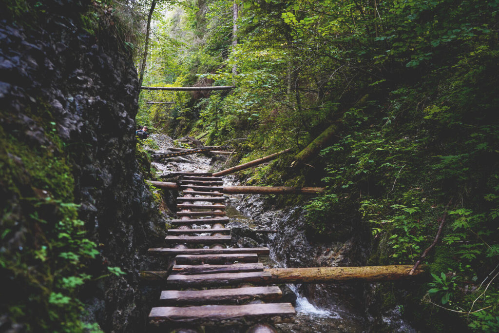
We simply have to share another highlight in this region with you. The area around Mount Veľký Rozsutec is a national nature reserve. This includes, among others, the Jánošíkové diery hiking trail. It is approximately 5.8 kilometers long and has several exciting sections. Metal ladders and footbridges repeatedly lead through the narrow valley cut into the rock. There are said to be more than 20 waterfalls in this area. At the starting point, you can see various routes on the map and choose one that suits you best.
Conclusion: Mala Fatra National Park
We had a wonderful day in Mala Fatra National Park. To be honest, we hadn’t expected it at all. The ridge hike was a lot of fun. We stopped again and again to savor the moment up there. The pleasant, cool mountain air, the green slopes and valleys, the rocky peaks, and the blue sky made the picture simply perfect. Again and again, we notice how comfortable we feel in the mountains, even though we are so close to the sea. Mountains are simply amazing.