A hike in the Mullerthal Valley should definitely be on your to-do list when traveling through our small neighboring country, Luxembourg. After exploring the capital and the beautiful Moselle wine region, our Luxembourg tour continued to the northeast of the country. In the green Mullerthal region (Luxembourgish: Mëllerdall), wild nature awaited us, with rushing rivers and streams, imposing rocky landscapes, pristine forests, and impressive moss-covered rock formations.
Purely visually, this region reminded us of the wonderful Saxon Switzerland, so it’s no wonder that this region is also often called “Luxembourg’s Little Switzerland.” If you are ever in Luxembourg, we definitely recommend an extended hike in the beautiful Mullerthal. In the following article, you will learn all about this region and our hike. Enjoy browsing!
- Welcome to the Mullerthal
- Hiking in the Mullerthal – Our Route
- Orientation within the Region
- Tip: Test Center & Equipment rental
- Our hotel in the Müllerthal
- Other hotels in the Müllerthal
- Other highlights in the Müllerthal
- Conclusion about the Müllerthal
Welcome to the Müllerthal
The further we drove northeast, the greener and more lush the landscape became. We were really looking forward to the next two days, as we had picked out a few great highlights. The Müllerthal is one of the 5 tourist regions in the country, which is especially popular with nature lovers, hikers, and bikers. Countless hiking trails lead through the region, be they local, national, or cross-border.
Very popular are the hiking trails E1, B1, B2, L2, as well as the 112 km long Müllerthal Trail, which takes you through all the region’s scenic highlights. Be sure to pick up a very well-structured hiking map (€4) and one or two brochures from a tourist information office. You’ll also find plenty of inspiration and many travel tips there. In a conversation with a member of staff, we also received many valuable insider tips.
By loading the map, you accept Google’s privacy policy.
Learn more
Load map
Hiking in the Müllerthal – Our Route
Part 1 – The Local Hiking Trail B5
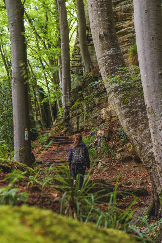
While many vacationers primarily hike individual stages of the Müllerthal Trail, the hotel recommended the two local hiking trails B2 and B5 to us, and we highly recommend this tour. We started directly from our accommodation, the Tail Inn Nature and Sports Hotel in Berdorf. From there, we hiked along the local hiking trail B5 through Berdorf toward the 55-meter-high Aquatower. Unfortunately, it was closed, so we couldn’t enjoy the magnificent view from the top. Directly behind the tower, we entered the forest, which provides pleasant shade, especially in the summer months.

Bizarre Rocks and Fairytale Caves
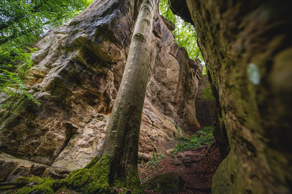
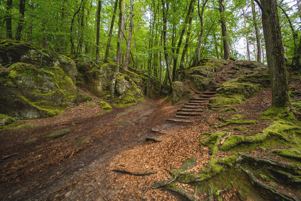
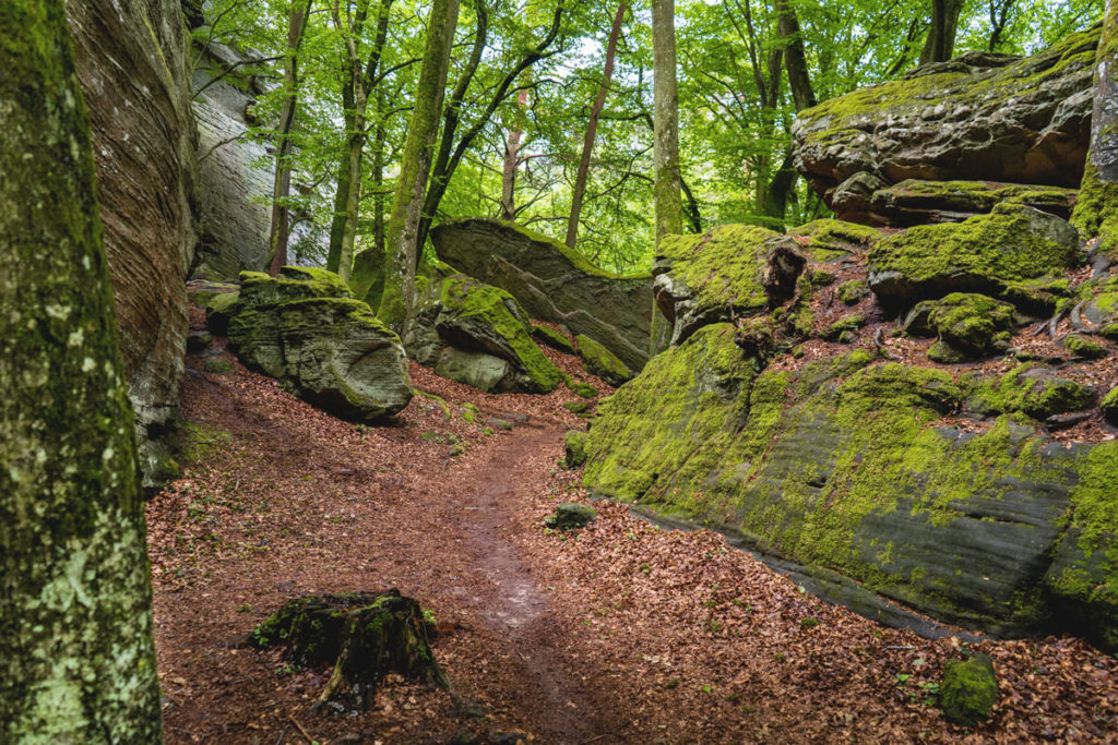
A few minutes later, the path led us down over 70 meters between bizarre rock formations, and more and more frequently, we discovered more crevices, caves, and plateaus, which together resembled a fairytale labyrinth. The giant trees that occasionally towered up next to us were also truly impressive. Not to forget the moss-covered stones along the path, which made this magical backdrop seem even more mystical.
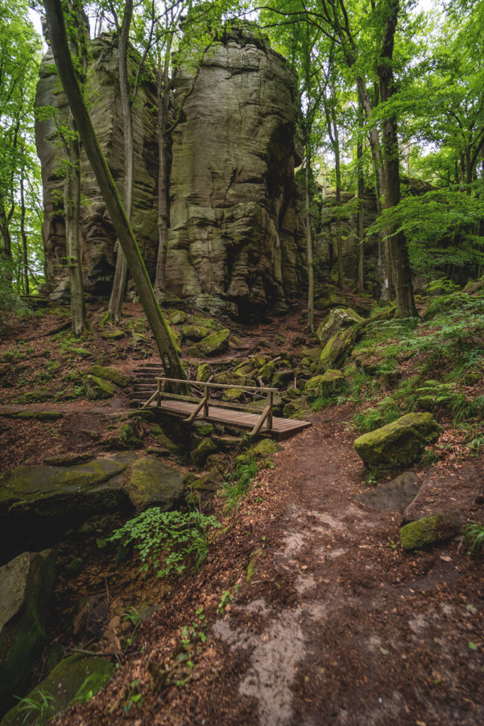
On the local hiking trail B5 there are the following highlights, among others: the Werschrummschlëff rock crevice, the Binzeltschlëff rock crevice and the Priedegtstull lookout point. You should plan on about 2 hours for the approximately 5.8 kilometers. However, you can also extend your hike and add the local hiking trail B2. That’s what we did and switched from the B5 to the B2 hiking trail shortly before the end.

Part 2 – The local hiking trail B2
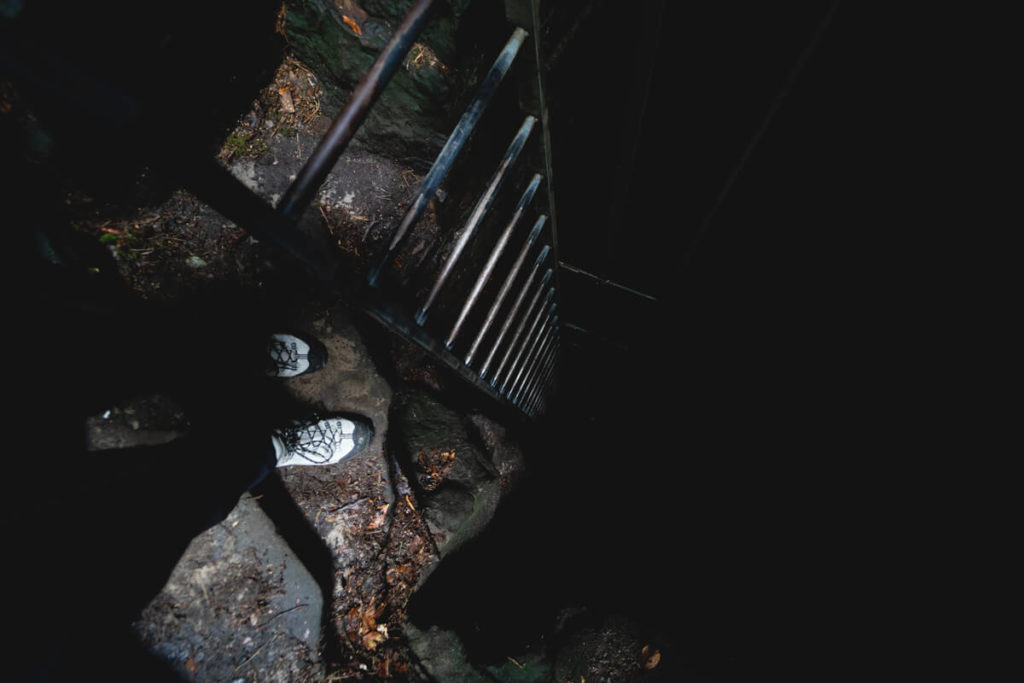
This circular hiking trail is particularly suitable for adventurers and nature lovers, whether children or adults. Right at the start of the hike, you reach the Ruetsbech rocky gorge and, a little later, the so-called “Raiberhiel” (German: Robber’s Cave). This cave is not for people with claustrophobia or a fear of the dark. An iron ladder leads through the cave up to the eagle’s nest. With the help of our flashlight on our smartphones, we were able to make our way through this dark cave.
Highly recommended are the climbs to the magnificent viewpoints of the Ruetsbech Plateau or Däiwelsinsel. The good thing is that you can reach many of the highlights in a very short time, eliminating the need for a day-long hike. The local hiking trail B2 later leads along the old Roman road, along the rocky chain, to the Waterbaach climbing garden. Here you’re sure to see many climbers at dizzying heights on the rocks.

After the climbing garden, the very narrow Siweschlëff crevice follows, before from Kaaselt the almost flat forest path returns to the Martbusch leisure center. You should allow 2 hours for the 4.2 kilometers. If you combine the B5 and B2 trails, expect a walking time of 4 to 5 hours. You can find possible hiking routes throughout the region here: Hiking in the Mullerthal.
Orientation within the Region
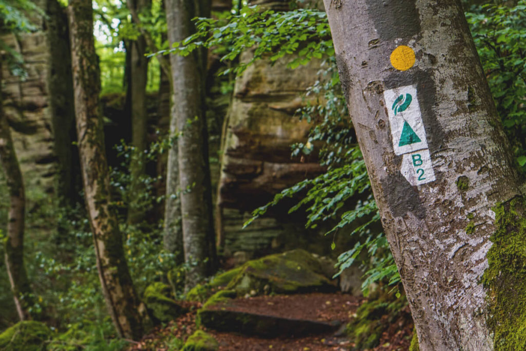
We found our way around the Mullerthal very easily. The hiking guidance system is very standardized and easy to understand, so we, as newcomers, were always on the right path. Sometimes we passed regular signposts, sometimes we found markers on trees. The Müllerthal Trail is marked by a red M on a white background, and the local hiking trails are marked with a green letter-number combination on a white background.
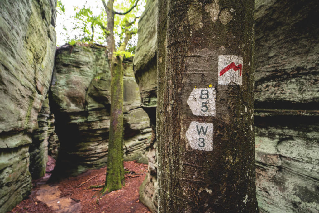
You can recognize the Auto-Pédestre hiking trails by blue signs with a blue triangle on a white background, which are marked with a “1” or “2” in one direction. National hiking trails are recognized by a yellow symbol on a blue background. We recommend the hiking map for €4, which you can purchase at tourist information centers (including hotels, etc.). You can also find some excellent brochures online: Müllerthal brochures.
Tip: Test Center & Equipment Rental
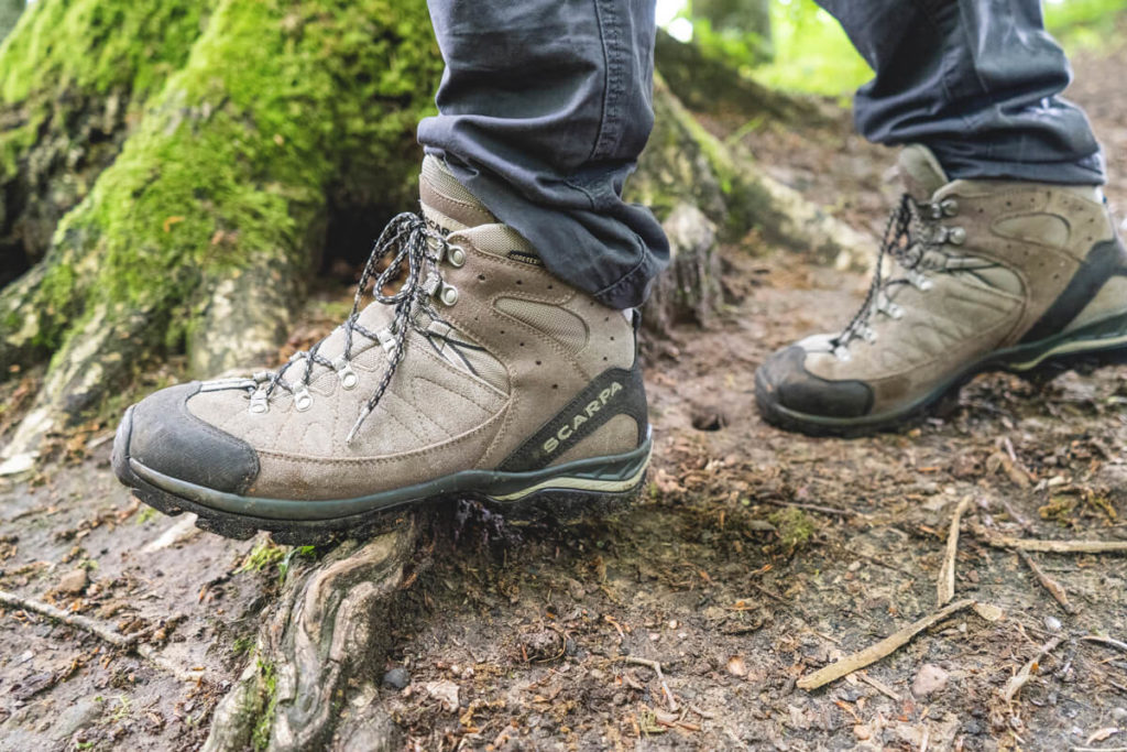
Did you know that there’s a test center in the region where you can borrow equipment for your hike completely free of charge? The Heringer Millen Test Center is located right in the heart of the region and offers hiking boots, backpacks, hiking poles, clothing, GPS trackers, and much more. All you have to do is show your ID and let them know how long you’d like to rent the equipment. Then we can get started right away.
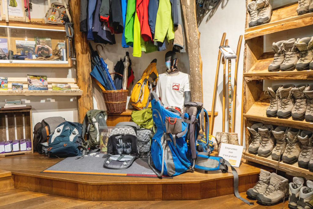
Since it had rained heavily the previous days and many trails were very slippery and muddy, we rented very sturdy, high-quality hiking boots. The staff also gave us excellent advice beforehand and many great tips (the test center is also the tourist information office). We rented the boots for two days, as we wanted to go hiking again the following day. There are similar test centers in various regions of Germany. You can find all the stations here: Best of Hiking – Test Center.
Our Hotel in the Müllerthal
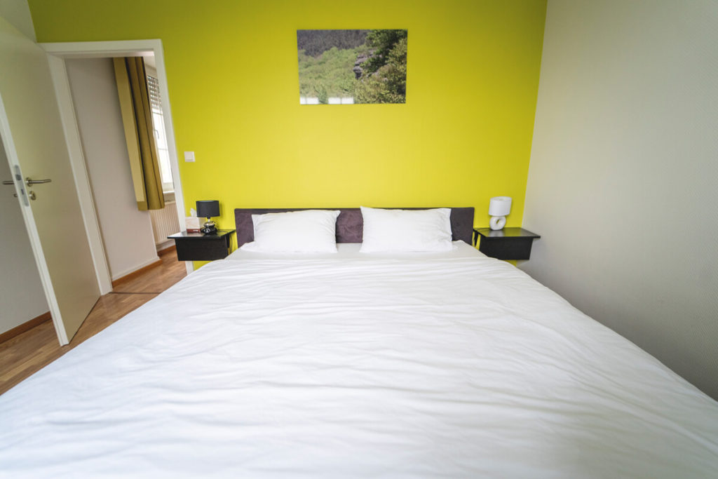
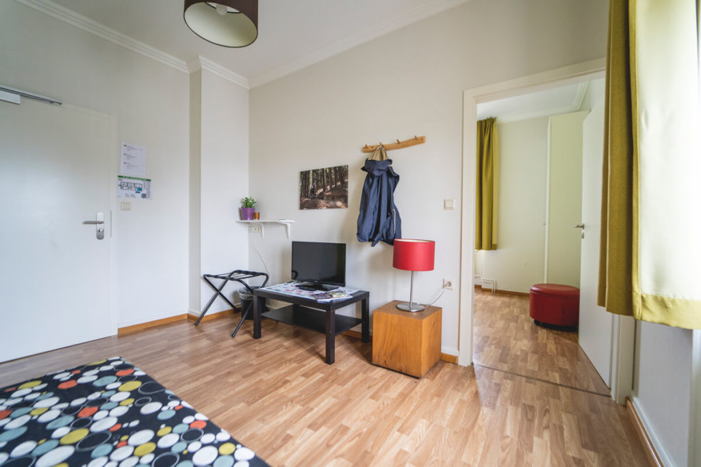
We stayed at the Trail-Inn Natur und Sporthotel Berdorf (4 out of 5 points on Tripadvisor), which served as a perfect central starting point for our tours. The hotel is just 6 kilometers west of Echternach and about 32 kilometers northeast of Luxembourg City (on Route 2 of the Müllerthal Trail). A cool bar, a shared lounge, a very good restaurant, and spacious rooms and apartments awaited us. We had free Wi-Fi in all areas.
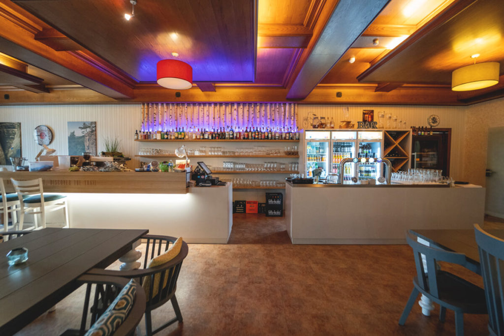
Our accommodation was very spacious and featured a bedroom with a double bed and wardrobe, as well as a living area with a sofa bed and TV. The bathroom had a shower, sink, and toilet. Visually, the rooms are rather functional and not particularly modern or nicely furnished (subjective opinion). The food in the restaurant was delicious, and the staff was super friendly and helpful. The area is ideal for biking and hiking. Book your room at the Trail Inn* here.
Other hotels in the Müllerthal
We highly recommend our hotel, the Trail-Inn Nature and Sports Hotel in Berdorf. It is ideally located and, above all, impresses with its value for money (from €50 per person). You can quickly reach all the region’s highlights without having to travel far by car. You can even start some hikes right outside the hotel. However, if the hotel is fully booked, take a closer look at the following accommodations:
More Highlights in the Müllerthal
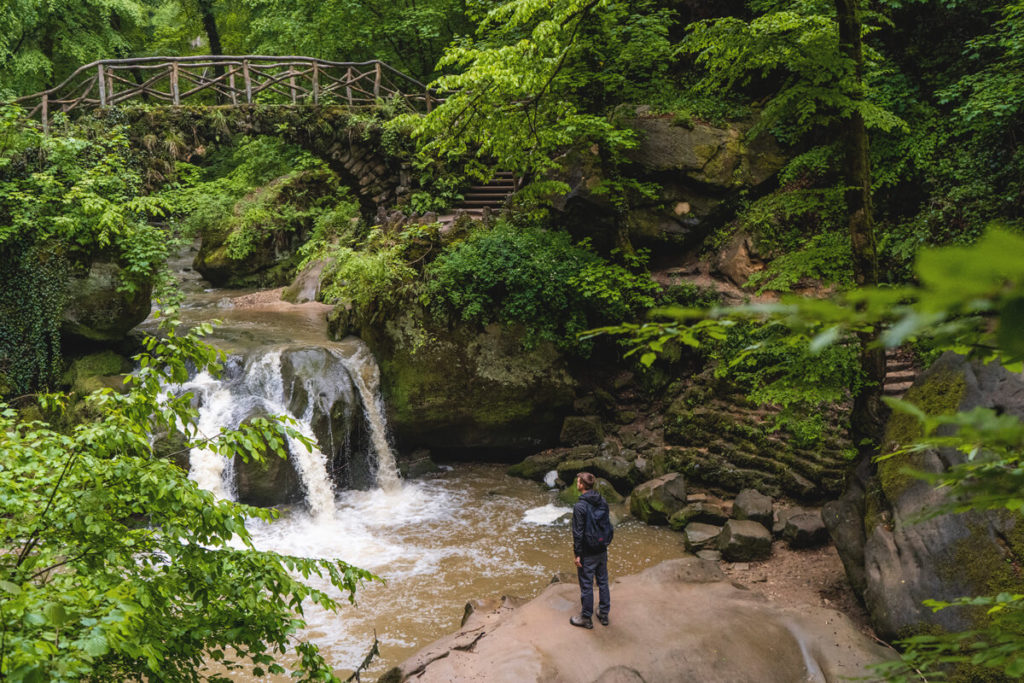
Schiessentümpel with Bridge
There are several other sights in the region that we naturally don’t want to withhold from you. Not far from the Heringer Millen Tourist Information Center is the so-called “Schiessentümpel” (Schéissendëmpel), which you can reach after a 15-minute walk. Here, the water cascades in three streams over the edge of the cliff into a kind of natural pool and then flows further towards the village. A pretty stone bridge with a wooden railing leads over the small, picturesque waterfall. From there, you can also undertake various hikes, for example to the Kallektuff spring, the Goldfralay rock formations, or the narrow crevices of Kuelscheier.
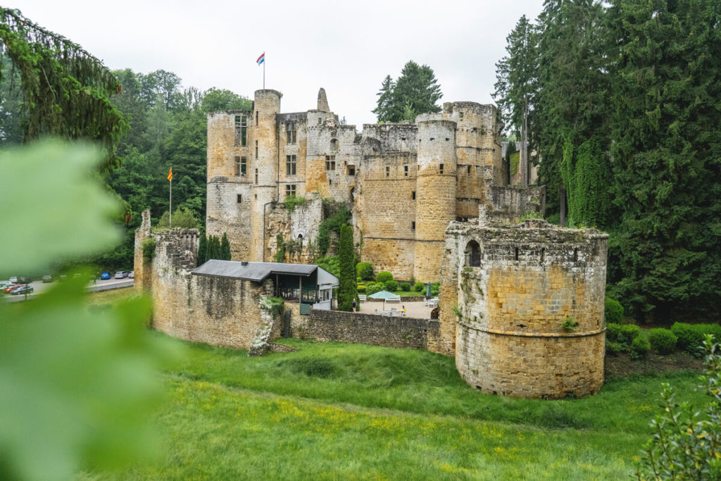
Beaufort Castle and Palace
A little further north is the Beaufort Castle, which can be admired not only from the outside but also from the inside. It is said that the inner castle was built in the 12th century. Since 1981, the castle and palace have been owned by the State of Luxembourg and can only be visited with a guided tour. You can visit the medieval castle every day from 9 a.m. to 6 p.m. (April and November), and the Renaissance castle from Thursday to Sunday between 11 a.m. and 4 p.m. (April and November).
Larochette Castle
Just about 10 kilometers from the Heringer Millen is Larochette Castle, which can also be visited. This old ruin lies about 50 meters above the small village of Larochette and is said to date back to the 11th century. Various exhibitions and concerts are now held between the walls of this old castle ruin. Opening hours: March 15 to October 31, always open between 10 a.m. and 6 p.m. Click here for the flyer.
Echternach
Just 6 kilometers east of Berdorf lies the pretty and charming town of Echternach. The oldest town in the country awaits you with winding streets, historic buildings, remnants of the city walls, cute cafés, and numerous restaurants. Simply stroll across the large market square and end the evening in one of these restaurants. We were also recommended the hike from Berdorf to Echternach, with its bizarre rock formations, deep gorges, and lush forests. Unfortunately, we didn’t have enough time for this hike.
Canoe tour from Dillingen
We had actually planned a canoe tour, but it was canceled at the last minute due to flooding. Nevertheless, we would like to introduce you to the possibility of exploring the area by canoe. In the Müllerthal, we found two providers that offer adventurous tours on the water: Kanu & Kayak Dillingen and Ronn’s Bikes & Kayak. The tours usually last between 2 and 3 hours and take you one-way from a starting point to a destination. You can return by bus, bike, on foot, or by taxi.
Conclusion on the Müllerthal
We love the Müllerthal and can highly recommend this region. If you love nature, enjoy hiking, and aren’t afraid of narrow crevices, you shouldn’t miss the Müllerthal. Of course, you don’t have to climb through any of the narrow crevices; you can always hike around them. But for adventurers, it’s an absolute highlight!
The region is wild and lush, as well as romantic and magical. We’re already looking forward to returning one day to do more hikes through the Müllerthal. If you’re ever in the area and decide to do another hike, we would be delighted if you would give us your feedback.