Hiking in the Swabian Alb? Why not? While many vacationers head to the Black Forest, Lake Constance, or the popular cities of Heidelberg, Stuttgart, Ulm, or Tübingen, the Swabian Alb is a more leisurely experience. Here, you’ll find virtually untouched nature, rolling hills, deep valleys, crystal-clear rivers, impressive rock formations, charming towns, and, of course, incredibly delicious food.
And the best part: mass tourism is a foreign concept in this region. On all our hikes, we hardly encountered other people and were able to enjoy nature to the fullest. The region offers over 90 certified hiking tours and also quieter paths through the unique natural landscape. In the following article, we present 4 varied hikes in the Swabian Alb. Enjoy browsing!
- The Swabian Alb
- Beautiful hiking routes in the Swabian Alb
- 1. Hochgehberge “hochgehpilgert” (Zwiefalten)
- 2. Traufgang Hossinger Leiter (Albstadt)
- 3. HochAlbPfad Felsquellweg (Meßstetten)
- 4. Ice Age Hunters’ Trail (Blaubeuren)
- Quality and premium hiking trails
- On the trail with the AlbCard
- Our accommodations on the Swabian Alb
- Hiking on the Swabian Alb – Our conclusion
The Swabian Alb
The Swabian Alb is part of the southwest German Jura Highlands and stretches over a length of approximately 220 kilometers. The region is characterized by rolling hills, deep valleys, karst landscapes, and impressive rock formations. The Swabian Alb is predominantly composed of Jurassic limestone, which was formed by geological processes over millions of years. The region also offers a diverse natural landscape with extensive forests, meadows, rivers, and lakes. In the numerous nature reserves of the Swabian Alb, you can explore a rich flora and fauna.

The region is also rich in cultural and historical sights. Hohenzollern Castle, the Hohenneuffen Castle ruins, Teck Castle, and Bebenhausen Monastery are just a few examples of historical sites found in the Swabian Alb. UNESCO has also recognized the Swabian Alb’s cave and ice age art program as a World Heritage Site due to the prehistoric artwork found there.

The Swabian Alb is a paradise for outdoor enthusiasts. There is a well-developed network of hiking trails, including the 360-kilometer-long Albsteig, which runs along the Alb ridge. In winter, the region also offers opportunities for downhill and cross-country skiing. And that’s not all, the Swabian Alb also awaits you with many worth-seeing towns, such as Blaubeuren, Ulm, Tübingen, and Bad Urach. Here you will be treated to culinary specialties, including Swabian Maultaschen (ravioli), Spätzle (spaetzle), and regional wines.
Beautiful Hiking Routes in the Swabian Alb
During our short tour through the Swabian Alb, we undertook four beautiful hikes. No two hikes were alike, which made the entire trip very varied. The quality and premium hiking trails were characterized primarily by natural paths, diverse landscapes, and impressive views. In the following section, we will present our hikes in more detail. If you can recommend a specific hike, please write it in the comments.
1. Hochgehberge “hochgehpilgert” (Zwiefalten)
The premium hiking trail “hochgehpilgert” is definitely one of our favorite trails from our recent trip. We started this tour at the Wimsen Cave parking lot (free of charge), from where the path led into the idyllic mixed forest. After about 2 kilometers, we reached the cozy “Loretto Zwiefalten” goat farm, which boasts a wood-fired bakery, a snack garden, and a beer garden. Unfortunately, it was closed (only open Friday to Sunday), but that didn’t stop us from enjoying the great view and paying the goats a visit.


From there, we strolled past large fields and flower meadows, descending into the picturesque village of Rental. This valley led us to the tranquil community of Zwiefalten, where we treated ourselves to a refreshment in the beautifully landscaped Zwiefalter Klosterbräu beer garden. Afterwards, we naturally admired the imposing Zwiefalten Minster before continuing our hike toward Wimsen. The path now led us along the banks of the crystal-clear Aach River up to the Trinity Cross, from where we enjoyed a sweeping view over Zwiefalten.


We particularly enjoyed the last part of the hike, as we now hiked through a wild, romantic valley with trees and turquoise springs. At some points, we felt like we were somewhere in Norway or Canada. Here and there, cozy benches and small barbecue areas invited us to rest. And of course, you can also cool off in the cool water. At the end of this great hiking trail, we spotted the idyllically situated Friedrichshöhle organic inn and the famous Wimsener Cave, which is clearly one of the highlights of the hike. More on this below…
Information about “hochgehpilgert”
- Length: 13.2 km
- Duration: 3.5 to 4 hours
- Start & Destination: Wimsener Höhle car park (individual)
- Route description: Map and details here
- Refreshment options: Loretto, Bio-Gasthof Friedrichshöhle, Zwiefalter Klosterbräu beer garden
- Highlights: Zwiefalter Minster, Loretto, Rental, Wimsener Höhle, Zwiefalter Aach
- Other routes: 20 more routes in the “Hochgehberge”


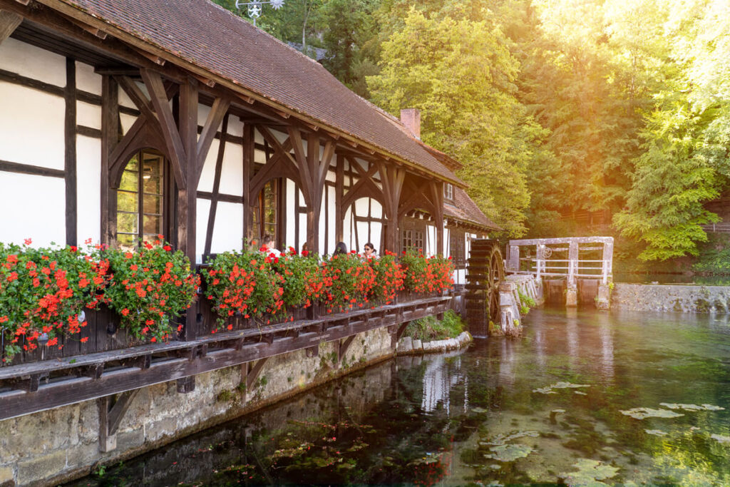
Special highlight: Wimsener Höhle
The Wimsener Höhle is one of the most impressive karst caves in the Swabian Alb, measuring around 1,260 meters in length. You can glide through the cave in a small boat and explore almost 70 meters of this impressive natural monument. The crystal-clear, turquoise-blue water is particularly worth seeing. The rear part of the Wimsen Cave is only accessible to experienced cave divers.
During the trip, you will learn some interesting information about the formation and geology of the cave. The cave has been explored, surveyed, and documented with the help of divers since the mid-1990s. To date, over 320 meters of underwater passages have been mapped, and a diving depth of 60 meters has been achieved. Tickets can be purchased on-site at the box office or reserved online in advance.
- Price: €6 adults, reduced price for children (free with AlbCard)
- Duration: Trip takes 8 to 10 minutes (arrive 15 minutes before departure)
- Note: Tickets may be fully booked on busy days
- Minimum age: 2 years; Pets are not allowed!

Tip: Sunset at the Hohengundelfingen Castle Ruins
If you are staying overnight in the area around Hayingen, Münsingen, Zwiefalten, and Ehingen, we recommend an evening tour to the Hohengundelfingen Castle Ruins. This castle towers above the “Großer Lauter” river in the Großes Lautertal valley and offers breathtaking views of the Swabian Alb, the Großes Lautertal valley, and even as far as the Alps. We were completely alone at this ruin in the evening and enjoyed the stunning sunset to the fullest. You can park at the hiking car park at the Hohengundelfingen ruins.

2. Hossinger Leiter (Albstadt)
Another hike in the Swabian Alb that we can recommend is the 9 km long Hossinger Leiter (Albstadt) in Albstadt. This premium hiking trail led us along the edge of the Alb to spectacular views and through a fairytale gorge. We started our tour in front of the Traufganghütte Brunnental and hiked leisurely uphill through lush forests and along picturesque meadows. After just under 2 kilometers, we reached imposing Jurassic cliffs and the iron steps of the Hossinger Ladder, which took us further up through the impressive gorge.


These steps were originally built as a path between Lautlingen and Hossingen, as they were the only access route around 100 years ago. The higher we climbed, the more breathtaking the views became. Arriving at Gräbelesberg, we followed the circular trail signs (approx. 1 km) and explored the various viewpoints above the steep cliff edges. Wow! The view of the Eyachtal Valley and the Alb foothills behind it couldn’t have been more beautiful.


After the scenic walk, we followed the path steeply down through the shady forest. After about four hours, we reached our starting point again. Since we always take lots of pictures and videos along the way, we generally take longer for hikes. At the Traufganghütte Brunnental, we treated ourselves to a delicious ice cream and a tasty espresso with milk as a reward. Afterwards, we strolled a bit through Albstadt.


Information about the “Hossinger Leiter”
- Length: 9 km
- Duration: 3.5 hours
- Start & Finish: Traufganghütte Brunnental car park
- Route description: Map and details here
- Refreshment options: Traufganghütte Brunnental
- Highlights: Hossinger Leiter, Gräbelesberg, weirs, panoramic view of the Eyachtal
- Other routes: 7 other Traufgang routes
Special highlight: Albstadt & Outlet Shopping
An important economic pillar of Albstadt is the textile industry. The town has a long tradition in the production of textiles and clothing. Some companies in this industry are known worldwide and contribute to the region’s economic development. Accordingly, you’ll find numerous outlets and shops where you can buy clothing, shoes, accessories, and fabrics. You can find an overview of the shops here: Outlets in Albstadt. In the town itself, you can also enjoy a leisurely coffee and stroll through the shops in the old town.

Tip: Sunset from the Böllat viewing rock
A very special highlight awaited us in the evening. We set off for the Böllat viewing rock just before sunset. You can reach it, for example, as part of a hike (Traufgang Felsenmeersteig) or comfortably by car (on Google Maps Böllat parking lot). There are several benches here for enjoying a fantastic sunset. If visibility is good, you can see across the Black Forest to the Vosges Mountains. The view of the landscape is simply unique. Highly recommended!

3. HochAlbPfad Felsquellweg (Meßstetten)
Looking for a hike that takes you through untouched nature, away from any tourist crowds? Then the HochAlbPfad Felsquellweg is the perfect choice. We started our hike at the parking lot of the Oberdigisheim reservoir. From there, the trail led us through the water-rich Kohlstattbrunnenbach valley with forest-lined hillside meadows. No urban noise could be heard far and wide, only the chirping of birds and the babbling of the stream. We used the time to take some beautiful detailed photos of nature.


We continued hiking across fields and meadows and after about two hours, reached the small village of Geyerbad. From there, the premium hiking trail led us up to the magnificent viewpoints of Sommerhaldenfelsen and Hohler Fels. These views above the Artleshaldentrauf couldn’t have been more beautiful. You can see six Messstetten districts at once, as well as the Albstadt district of Langenwand. Of course, we took the opportunity to take a break or two.


The path now descended somewhat more steeply back towards the reservoir. Below Sommerhalde and Artleshalde, we hiked along an idyllic path through juniper heaths. After about 3.5 hours, we were back at the car, from where we made a detour to the Oberdigisheim reservoir. This is idyllically nestled in the natural surroundings of the Swabian Alb and invites you to linger, sunbathe, and swim. A circular path leads around the lake; restrooms and changing rooms are also available.
Information about the “HochAlbPfad”
- Length: 9.7 km
- Duration: 3.5 hours
- Start & Destination: Parking lot at the Oberdigisheim reservoir
- Route description: Map and details here
- Refreshment options: none along the way, only in the surrounding towns
- Highlights: Reservoir, Kohlstattbrunnenbachtal, Sommerhaldenfelsen, Hohler Fels
- Other routes: 2 other routes on the HochAlbPfade

Special highlight: Tieringen barefoot path
After the hike, we recommend a detour to the Tieringen barefoot path. The approximately 900 m long circular trail takes you over various surfaces, such as gravel, glass, sand, wood, and bark mulch, as well as through water and mud. We generally walk barefoot far too rarely in everyday life, even though walking without shoes strengthens the ligaments and muscles and stimulates the foot reflex zones. It’s all the more wonderful that Tieringen has this trail. At the end of the barefoot trail, there are washing facilities next to the Schlichemhalle.
- Address: Hinter Burg 22, 72469 Meßstetten
- Opening hours: year-round; Free access
- Admission: free


Tip: Stop at the Berghütte Inn
After our hike, we drove up to the Berghütte Inn. We enjoyed homemade cake and coffee in a cozy atmosphere. The menu also includes local specialties and hearty dishes. In good weather, you can relax outside on the terrace. The inn is very popular, which is why reservations are advisable during the season (especially on weekends).
- Address: Berghof, 72469 Meßstetten
- Opening hours: Wed. – Mon. 11:30 a.m. to 10 p.m.
- Reservations at: +4974361551

4. Ice Age Hunters’ Trail (Blaubeuren)
The Ice Age Hunters’ Trail in the Swabian Alb is known for its connection to Ice Age hunters and the spectacular finds of prehistoric art. It takes you back in time and leads you past impressive rock formations and caves, where, among other things, some of humanity’s oldest known works of art were found. These works of art date back to the last Ice Age, about 40,000 years ago, and are a fascinating testament to the creativity of our ancestors.


Our hike started at the train station in Blaubeuren, where we could park our car for free. From there, the path led us up the steep slope of the Weiler Halde to the Brillenhöhle cave and further through the rock labyrinth past the Kissing Pig. A little later, we reached the medieval ruins of Günzelburg, from where we enjoyed a beautiful view of the Ach Valley.


From the ruins, we gradually hiked back down into the valley before reaching the “Geißenklösterle” cave via a narrow path. We then had a truly beautiful view from the Bischoffelsen and the Schillerstein. The “Zum Schillerstein” forest restaurant is also nearby, where you can stop for a cozy break. The path led us from the restaurant along a forest path back to Blaubeuren and the train station.
Information about the “Ice Age Hunters’ Trail”
- Length: 10.8 km
- Duration: 3.5 hours
- Start & Destination: Blaubeuren train station car park
- Route description: Map and details here
- Refreshment options: “zum Schillerstein” forest restaurant
- Highlights: Kissing Pig, Brillenhöhle, Günzelburg ruins, Geißenklösterle, Schillerstein
- Other routes: 19 other routes on the Ice Age Trails

Special highlight: Blaubeuren & Blautopf
We highly recommend an exploration tour of the town of Blaubeuren. It boasts a charming old town with well-preserved half-timbered houses, a market square, and cozy alleys that invite you to stroll. The surrounding area of Blaubeuren is characterized by breathtaking scenery, ideal for hiking and exploring the Swabian Alb. We ended our beautiful day of hiking here in a relaxed atmosphere. A signposted old town circular route leads you to the most beautiful spots in town.


A special highlight is, of course, the The so-called “Blautopf” (Blue Pot). This is one of the largest karst springs in Germany and a stunning example of the geological wonders that the Swabian Alb has to offer. The spring gets its name from the stunning blue color of the water, which is caused by the refraction of light through the mineral-rich water. The Blautopf is up to 21 meters deep and can only be explored by cave divers. The Blauhöhle (Blue Cave) system has already been explored over a length of over 13 kilometers. A beautifully landscaped circular path leads you around the Blautopf.


Tip: Prehistoric Museum in Blaubeuren
A visit to the Prehistoric Museum in Blaubeuren is a must-do while you hike. The museum is known for its collection of prehistoric artifacts and fossils from the region and offers insights into the prehistory of the Swabian Alb. A highlight of the museum is the Venus of Hohle Fels, an approximately 40,000-year-old figurine, which is one of the oldest depictions of a female figure and was found in the Swabian Alb. The figurine is an important testimony to the cultural development of humans during the Ice Age.
- Address: Kirchplatz 10, 89143 Blaubeuren
- Opening hours: Tues. – Sun. from 10 a.m. to 5 p.m.
- Admission price: €7; Reduced: €5 (free with the AlbCard)

Quality and Premium Hiking Trails
During our trip, we repeatedly asked ourselves what actually constitutes a quality and premium hiking trail. These are hiking trails that have special features to offer hikers an outstanding nature experience and a high-quality hiking experience. These hiking trails can be found in many countries around the world and are often defined by certification programs or special quality standards.
☞ Find premium hiking trails in Germany.
These standards can relate to various aspects of the hiking trail, including signage, route guidance, landscape, safety, and infrastructure. The hiking trails are usually well signposted and marked to help hikers find their way around. This can be done through colored markings, signposts, information boards, and maps. You can take a closer look at the criteria on the following page: Criteria for the German Hiking Seal.

Quality and premium hiking trails also often place emphasis on protecting the environment and natural resources. Measures are taken to preserve ecosystems along the trail and minimize the impact of hiking on nature. These trails often offer good infrastructure for hikers, including rest areas, picnic areas, restrooms, and occasionally accommodations. Service facilities may vary by region.
Premium hiking trails also often lead through diverse landscapes, including forests, mountains, rivers, lakes, and coastlines. The main goal of these trails is to offer hikers a special experience. This can be achieved through spectacular views, historical sights, cultural experiences, and other attractions along the trail. You can find the best certified tours in the Alb here: www.albwandern.de.
On the Road with the AlbCard
We were traveling with the AlbCard. This is a guest card or tourism card offered in the Swabian Alb region. It gave us various discounts and free services during our stay. One of the main attractions of the AlbCard is free use of public transport in the region. This makes exploring the Swabian Alb convenient and comfortable without having to pay for tickets.
We also think it’s really cool that the AlbCard gives you free admission to 160 attractions and experiences. These include the Skypark Kletterwald (climbing forest), the Bud Spencer outdoor pool, the HöhlenErlebnisWelt (cave adventure world), the Prehistoric Museum in Blaubeuren, the Tiefenhöhle (depth cave) in Laichingen, the AlbThermen (bad Urach) spa, and the Bärenhöhle (bear cave). With the card, you can even rent an e-bike for free. ☞ All AlbCard highlights here.

You will receive the AlbCard from 149 participating hotels, inns, holiday apartments, and other accommodations in the Swabian Alb upon arrival. With the AlbCard, you can use each attraction once per stay. You have one day of use per overnight stay. If you have booked 3 nights, you can use the card on 3 consecutive days. And the best part: the AlbCard is completely free for you!
Our accommodations on the Swabian Alb
During our short 4-day hiking tour, we stayed in three different accommodations, all of which are AlbCard partners. In the following section, we would like to briefly introduce you to these hotels. introduce. ☞ To all AlbCard partners.
1. Gasthof Hotel zum Ochsen
At the beginning of our trip, we stayed at the Gasthof Hotel zum Ochsen, which is located in Berghülen and only 10 minutes from Blaubeuren. A modern room with a queen-size bed, bathroom with shower, desk, TV, Wi-Fi, and safe awaited us. The hotel also has its own (very good!) restaurant, an indoor pool with sauna, and free parking.

2. Bio-Hotel Restaurant Rose
We highly recommend the Stylish Bio-Hotel Restaurant Rose in Hayingen. The hotel, run by the Tress brothers, has made sustainability a top priority. We really enjoyed our themed room with a very comfortable bed, desk, seating area, and balcony. In the in-house restaurant, top organic chef Simon Tress treated us to delicious, very healthy dishes. The hotel also has a cozy lounge and a garden with seating.

3. Hotel Krone Lautlingen
We spent our last night at the Hotel Krone Lautlingen. The new hotel building was constructed from solid wood, which emphasizes the hotel’s connection to nature. wanted to make clear. Our room was very comfortably furnished with a Swiss stone pine bed, desk, seating, and a modern bathroom with a shower. The hotel also houses a cute farm shop with regional products and an inn where you can enjoy sophisticated and traditional Swabian dishes.

Hiking in the Swabian Alb – Our Conclusion
So, what can we say in summary? We really enjoyed our trip through the Swabian Alb. We actually didn’t expect to discover so many great places. The Swabian Alb impressed us above all with its untouched nature and diverse landscapes, including forests, meadows, cliffs, gorges, and caves. We also particularly enjoyed the numerous viewpoints from which we could admire the beauty of the region.
Of course, the historic towns, castles, monasteries, and museums shouldn’t go unmentioned, as there’s a lot to discover here. After our hikes in the Swabian Alb, we also thoroughly enjoyed the regional cuisine. The Alb is known for its delicious specialties such as Maultaschen (swabian pasta), Spätzle (spaetzle), and regional wines. Whether you’re looking for a challenge or simply want to enjoy the peace and beauty of the landscape, the Swabian Alb has something to offer everyone. We’ll definitely be back!