We finally visited Saxon Switzerland in Saxony recently. To be honest, we don’t know why we’d never been there before. It just never seemed like the time had come up, so we were all the more spontaneous. A week before our departure, we came up with the idea of traveling to this region, as we still had some free time. A hotel was out of the question; we really wanted a tent, sleeping bag, and sleeping mat.
With all our camping gear, we set off with Horst (our car) to Königstein and spent 6 magical days in the region. In today’s post, we’d like to introduce you to our most beautiful sights in Saxon Switzerland. We hope our tips will help you plan your trip more easily. Enjoy browsing!
- 1. The Schrammstein Viewpoint
- 2. The Wild Hell
- 3. The Carola Rock
- 4. Frienstein and Ida Grotto
- 5. Cowshed and Ladder to Heaven
- 6. The pretty spa town of Rathen
- 7. The Bastei and Bastei Bridge
- 8. The Schwedenlöcher (Sweden Holes)
- 9. The Amselsee (Amsel Lake)
- 10. The beautiful Polenz Valley
- 11. The Pfaffenstein (Pfaffenstein Rock)
- 12. The Hercules Columns
- 13. Short break in Pirna
- 14. The Elbe Cycle Path
- 15. Upper Lock and Boat Trip
- Conclusion on Saxon Switzerland
- Königstein Campsite
- Our camping equipment
- Tip: The famous Painter’s Trail
1. The Schrammstein Viewpoint
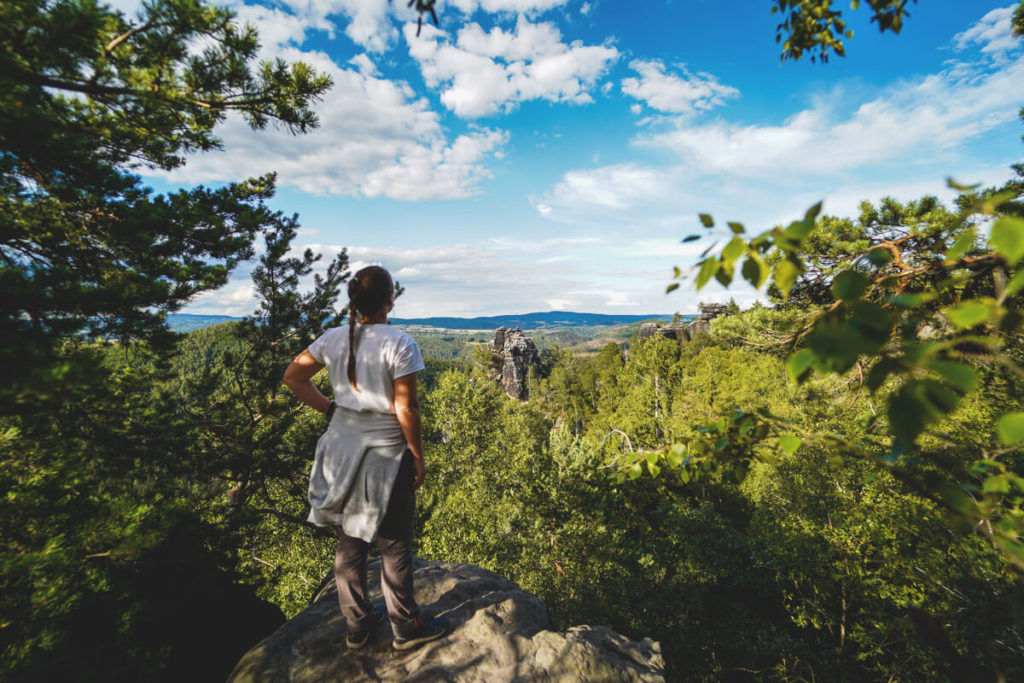
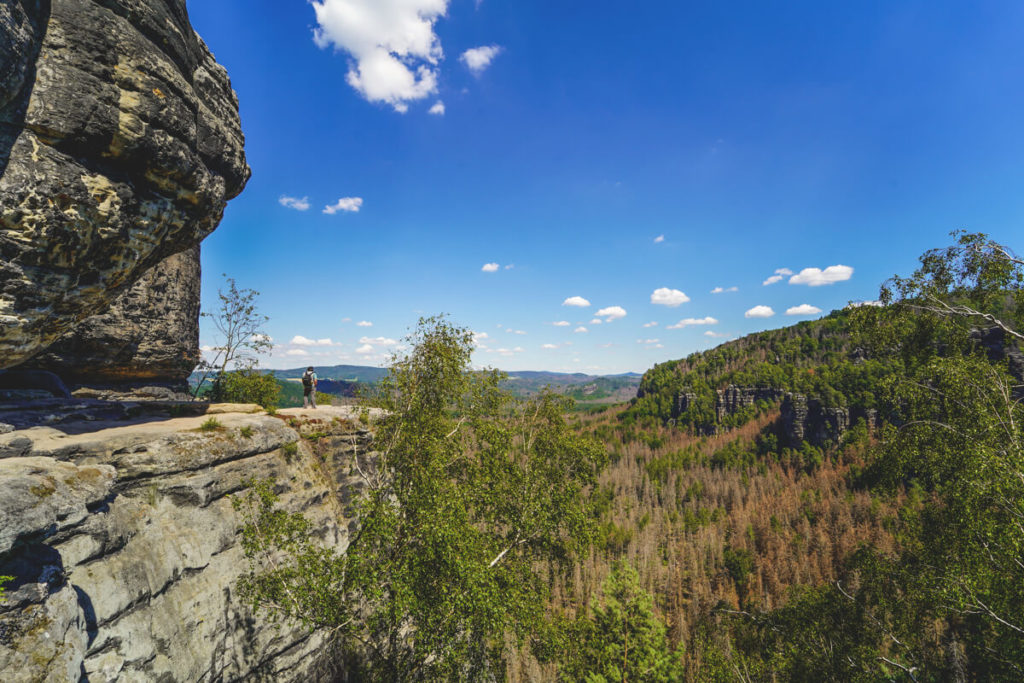
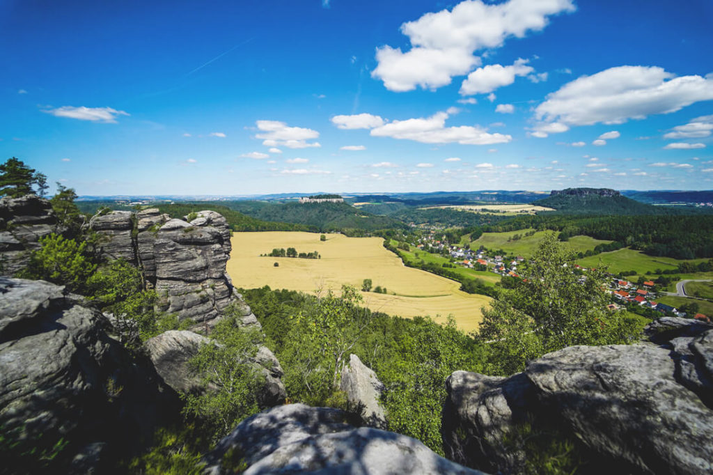
The hike to the Schrammsteine is definitely one of our favorite sights in Saxon Switzerland. This jagged rock formation is located very close to Bad Schandau and can be reached from the “Nasser Grund” parking lot in about 60 to 90 minutes. Once at the top, you’ll find a narrow rocky ridge with a rather steep drop. You don’t have to be afraid here, but a fear of heights would be a bit of a hindrance for this tour. The views from the platform are breathtaking and make up for the strenuous climb to the top.

We recommend a certain level of fitness for this hike, as you’ll repeatedly climb steps and iron ladders. You might want to avoid the Schrammsteine on weekends, as previous visitors have reported that it can get quite crowded. We were on the viewing platform around 4/5 p.m. and found it very relaxed and not at all crowded. Combine the Schrammstein viewpoint with other highlights in the area, such as the Carolafelsen or the Kuhstall. You can find great hikes further down on this page: www.komoot.de.
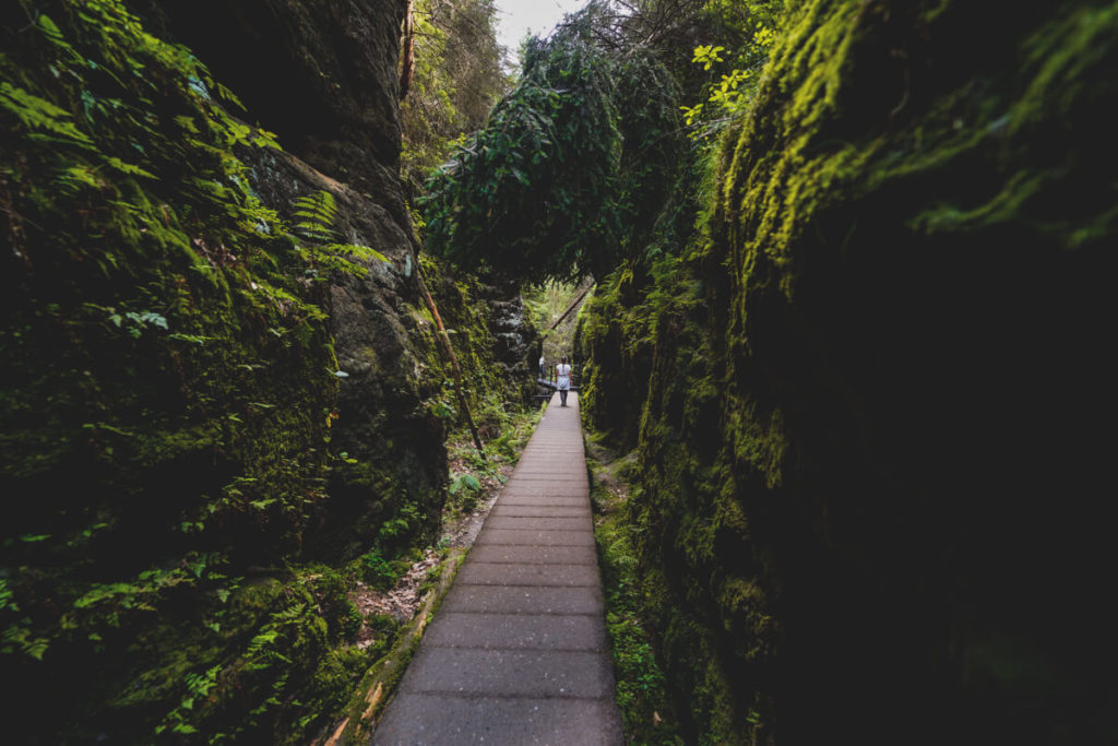
2. The Wild Hell
On the way to the Carolafelsen, we had to go through the “Wild Hell.” This is a wildly romantic staircase through a lush green and rocky gorge. Along the way, we walked over large tree roots, huge stones, ladders, crampons, and handholds attached to the rocks. Here, too, we recommend a certain level of fitness and, above all, sturdy footwear. In our opinion, there were no “tricky” spots on this trail that could trigger a fear of heights.
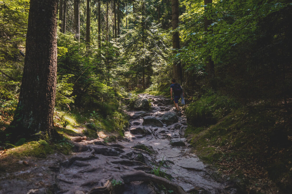
You can wonderfully combine this hike with the Carolafelsen, as well as with the Affensteine, the Idagrotte, the Zwillingsstiege and the Häntzschelstiege (please do not use it without a safety harness!!!). After the Wild Hell, we continued on to the Carolafelsen, but more on that in the next section. We particularly liked the fact that we kept finding pleasantly cool spots between the rocks for a break.
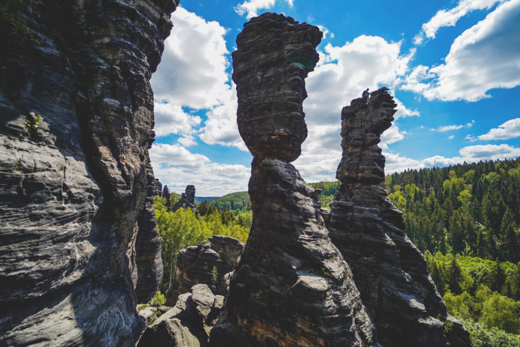
3. The Carolafelsen
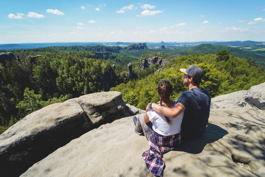
At the end of the “Wild Hell,” the trail continues to the viewpoint on the Carolafelsen. Here, only a few rocky steps separate you from your destination. The Carolafelsen lies amidst the Affensteine and, at 458 meters, is the highest peak in this group of rocks. From the many different rocks, you have beautiful views of the back of the Schrammsteine, the Falkenstein, and even the Lilienstein, which lies behind it. For us personally, the Carolafelsen is one of the top sights in Saxon Switzerland.
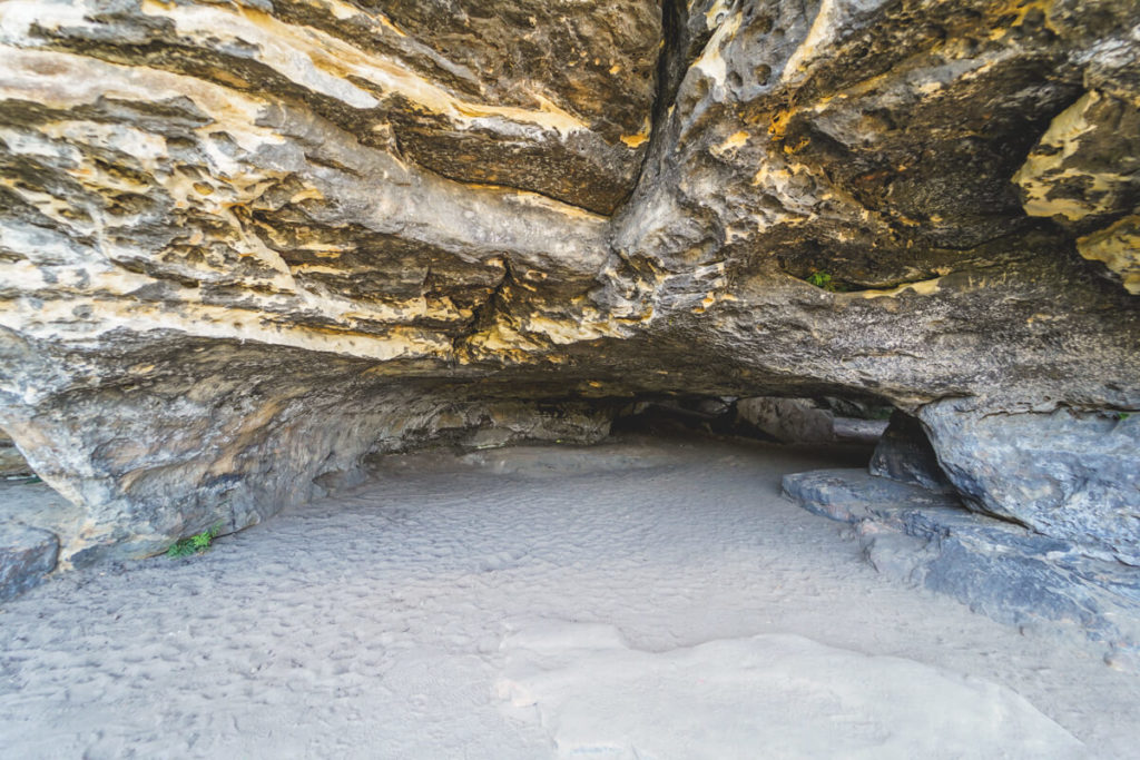
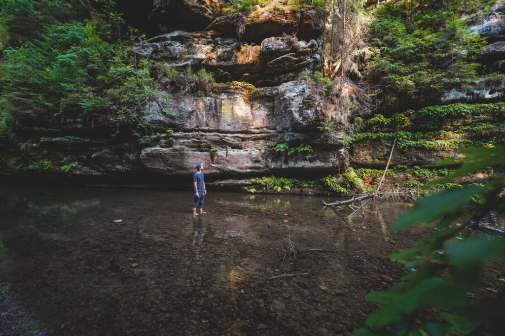
4. Frienstein and Idagrotte
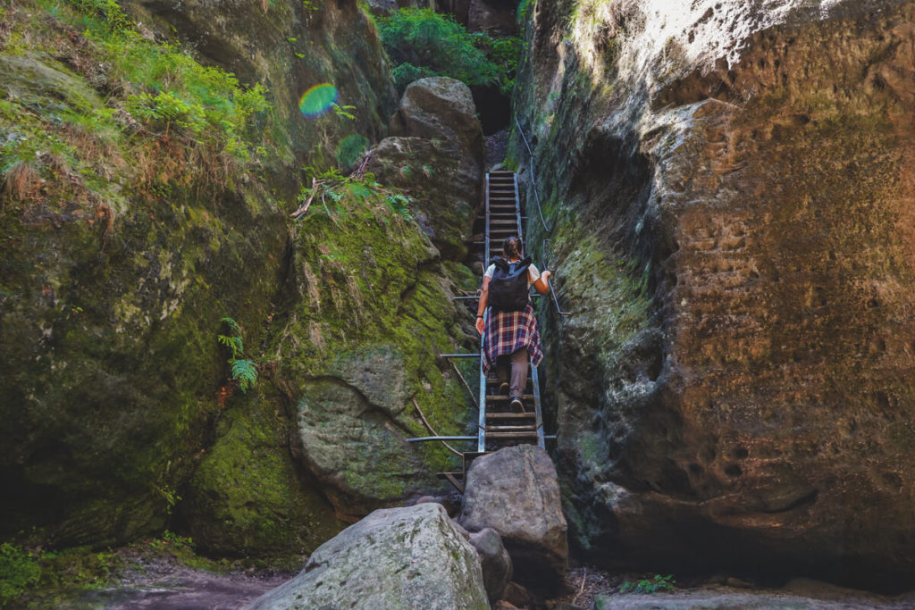
From the Carolafelsen, we hiked further to the Frienstein and the Idagrotte. The path there felt quite long, but wasn’t particularly strenuous. On the east side of the Frienstein is the Idagrotte, a truly large cave with clefts and strata. You definitely shouldn’t be afraid of heights for this attraction in Saxon Switzerland, as you can only reach the grotto via a narrow (very short) path along the precipice. However, iron handholds on the rock give you the necessary security to master this narrow path.
Once you’ve completed this short stretch, you can take a closer look at the grotto and enjoy the views. Traces and evidence were apparently found here that this grotto was used as a living space as early as the Middle Ages. It’s a strange feeling, knowing this, to walk through this type of cave. What must it have looked like back then when people still lived there? Who knows… From Frienstein, we continued our hike to the Kuhstall and the Himmelsleiter (Stairway to Heaven).
5. Kuhstall & Himmelsleiter
Many of our readers recommended the tour to the Kuhstall and the Himmelseiter (Stairway to Heaven). No sooner said than done! From the Idagrotte, we continued our hike and, somewhat tired and worn out, reached the Kuhstall Rock Gate in the late afternoon. You can also reach this sight from the Lichtenhain Waterfall in about 30 minutes. During the Thirty Years’ War, residents are said to have hidden here with their livestock from Swedish soldiers. This is probably where the name “Cowshed” comes from.
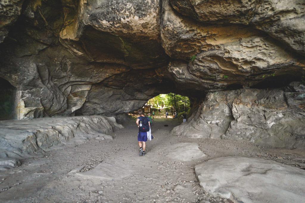
The rock gate is about 11 meters high, 17 meters wide, and 24 meters deep. You can walk through it and enjoy the view of the rocky landscape. To the left, there is a crevice in the rock through which you reach the Stairway to Heaven. This is an extremely narrow staircase that leads up through the rock. We found the view from up there even better. But you shouldn’t be claustrophobic! There’s a restaurant, restrooms, and seating on site.
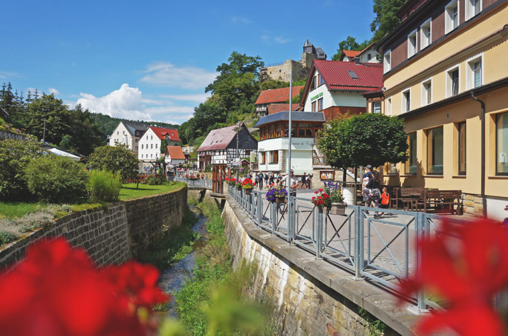
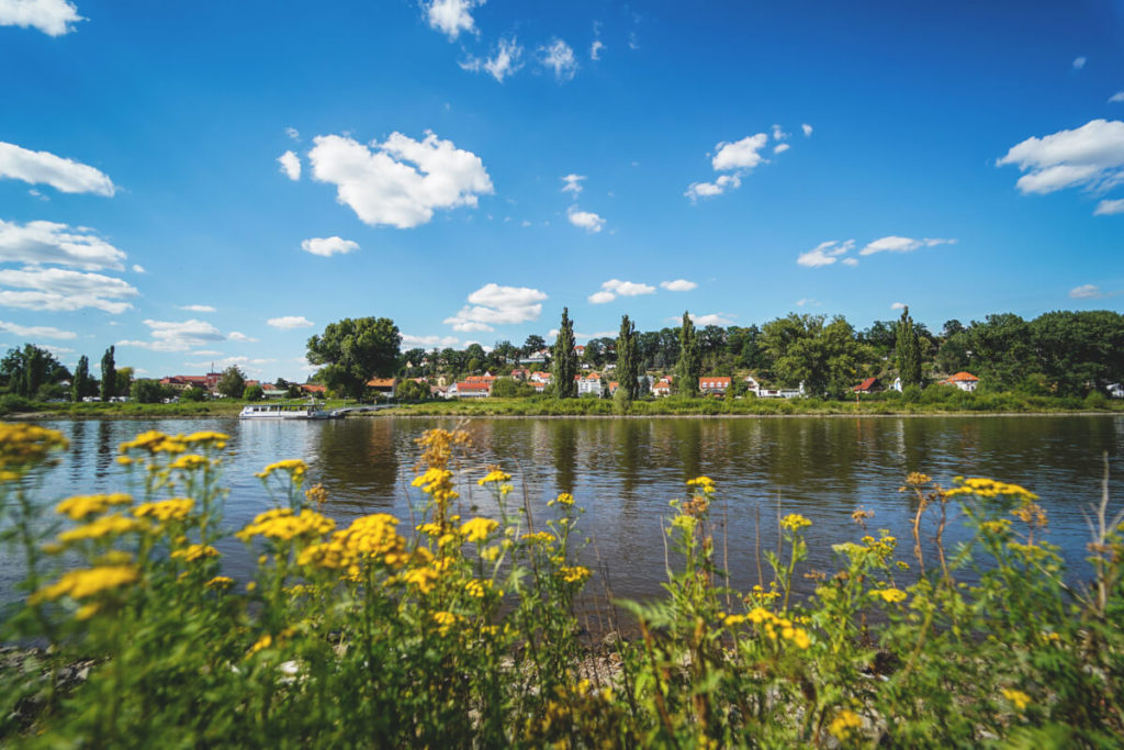
6. The pretty spa town of Rathen
The spa town of Rathen in Saxon Switzerland is located directly on the Elbe River and at the foot of the Bastei. We started our day hike here and passed through this pretty town on our way to the Bastei Bridge. Rathen is a great starting point for the Bastei and the Schwedenlöcher. You can also enjoy a leisurely coffee here or order something delicious to eat in one of the restaurants. Ice cream and souvenirs are also available. You can also reach Rathen by ferry from the other side of the river.
7. The Bastei & Bastei Bridge
From Rathen, the route goes directly up to the Bastei and Bastei Bridge. This rock formation is one of the most visited sights in Saxon Switzerland and is also a landmark of the region. So be prepared to share the beautiful viewpoints with many other people. Awaiting you are a 76-meter-long bridge, the ruins of the Neurathen Castle, great viewpoints, a restaurant, a snack bar, restrooms, and the Berghotel Bastei*. You only pay admission for the ruins (€2); everything else won’t cost you a cent.
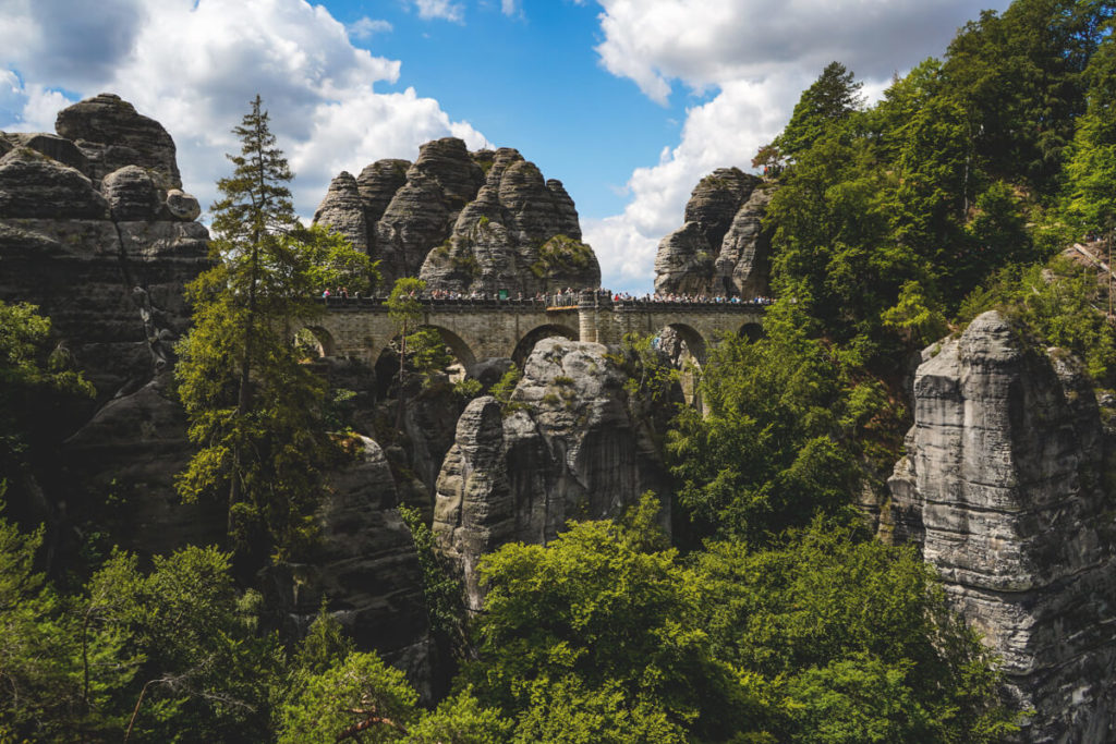
You can visit the Bastei all year round; it’s open 24 hours a day. We were advised to come to the Bastei at sunrise, as there are supposed to be few people around so early in the morning. If you don’t want to hike, you can also drive or take the bus to the Bastei. Parking lot number 2 costs €7 per day (3 hours cost €5).
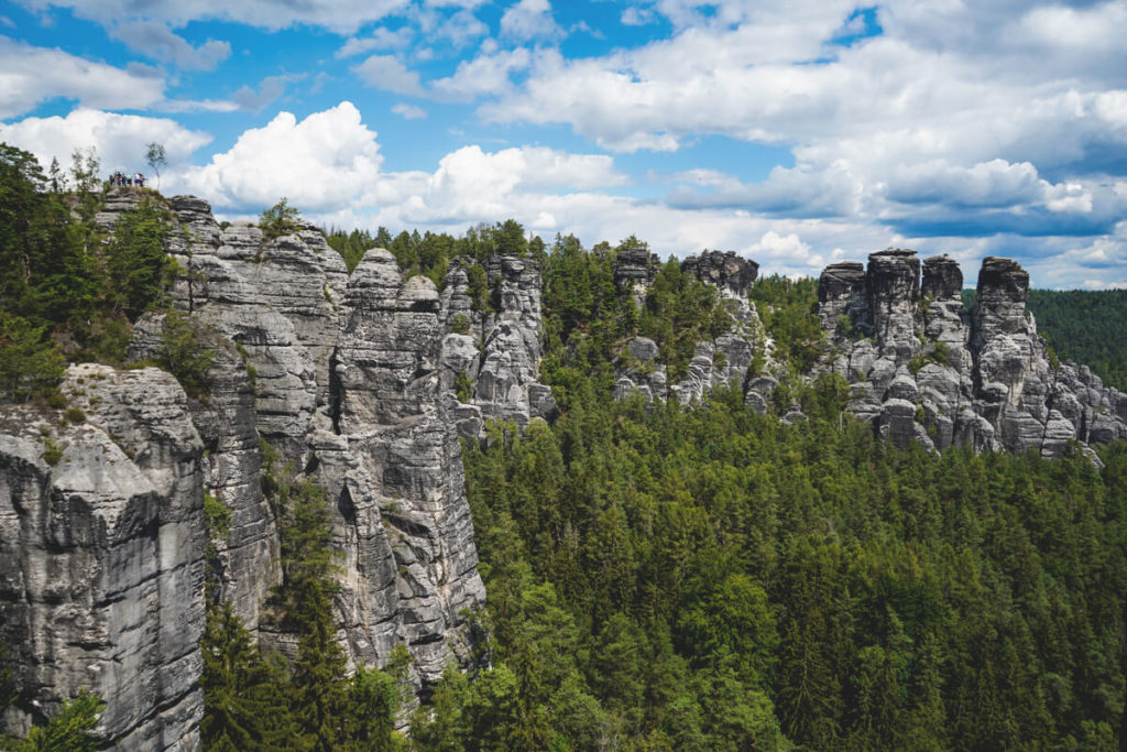
Actually, all viewpoints are recommended and always offer a different view of the bizarre rock formations (overview map here). We paid the €2 entrance fee for the ruins and were treated to beautiful views from several spots. Despite the very high number of tourists, the trip is well worth it, as this landscape is simply unique. Click here for our detailed report on the Bastei & the Bastei Bridge.
8. The Swedish Holes
From the Bastei, we continue to the Swedish Holes. For us, this magical descent is definitely one of the top sights in Saxon Switzerland. Simply follow the blue trail and prepare yourself for a magical, gorge-like rocky ravine over numerous small bridges, stairs, and through caves and rock passages. It was still quite busy here, but that didn’t detract from the beautiful scenery. We recommend the route from the Bastei, as you only have to walk downhill. Going the other way around will definitely work up a sweat with the more than 700 steps!
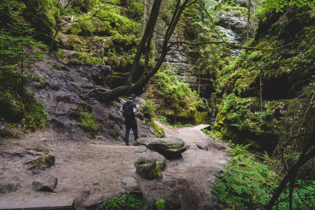
You might be wondering why this gorge is called “Swedish Holes”? During the Thirty Years’ War, the inhabitants of the surrounding villages sought refuge from the Swedes in these rock formations. Hence the name of the path between Amselgrund and Bastei, “Schwedenlöcher.” When you reach the end, keep right to reach the idyllic Amselsee. We turned left beforehand to visit the Amselfallbaude (historic mountain lodge in Amselgrund), which was, however, still cordoned off. You can read about our hike and route here.
9. The Amselsee
At the end of the Schwedenlöcher, you’ll reach the Amselsee on the right. This 500-meter-long lake was dammed in 1934 and was once used for ice production and fish farming. Here you can take a break, leisurely circumnavigate the lake (20 minutes), or take a boat trip (rowboat or pedal boat). Thirty minutes currently costs €4 per boat. What’s also really cool is that you can even ice skate on the lake in winter! We sat down on the shore and took a short picnic break before continuing our tour.
10. The beautiful Polenz Valley
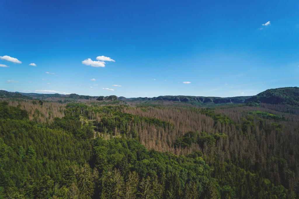
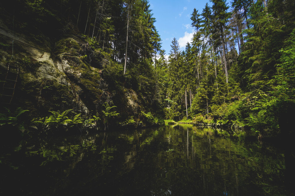
For many, the circular hike ends at Amselsee, and it’s time to return to the starting point. We were still fit and hiked on to Hohnstein and the Wolfsschlucht Gorge. Finally, we reached the beautiful Polenz Valley. This valley is located between Hohnstein, Neustadt, and Stolpen. We continued along the Polenz River before reaching the parking lot, where we started our day trip. We found the 20 km long valley with its up to 150 m high rock faces and lush mixed forest to be truly beautiful and relaxing.
11. The Pfaffenstein
We received the tip from our community to definitely explore the Pfaffenstein. We rented two cool e-bikes early in the morning (from Kanu Aktiv Tours in Königstein) and set off on a 55 km long but relaxed tour. First, we went from Königstein to Pfaffenstein, a ride that took about 20 to 25 minutes. The Pfaffenstein table mountain is around 434 meters high and is located near Pfaffendorf. Here, you can expect stunning views and the famous 43-meter-high rock needle, the “Barbarine.”
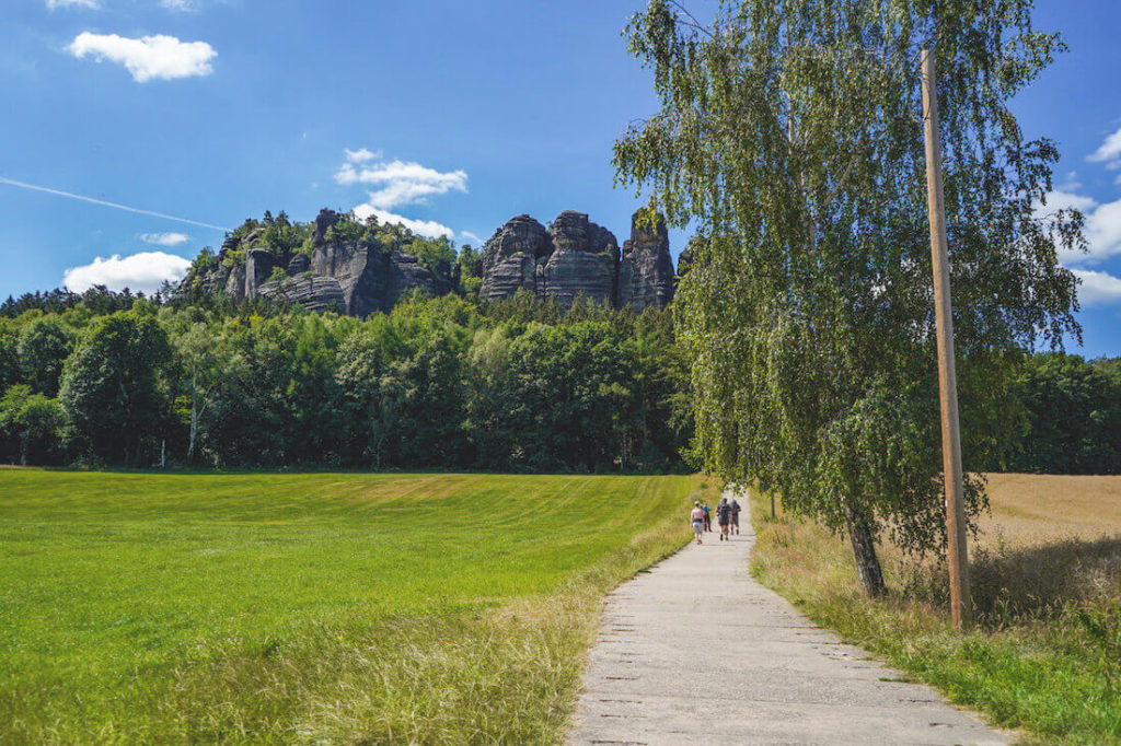
There are various routes up to the rocky plateau. We took the “difficult” route through the eye of the needle, which is also the shortest. We were at the top in just 15 or 20 minutes. This involves climbing around 600 steps, which is truly strenuous. Along the way, an iron ladder leads through a narrow hole in the rock (a needle’s eye) – not for those with claustrophobia or a fear of heights. Another path leads past the Jäckelfels to the right and is said to be very comfortable. This climb takes around 35 minutes, but was closed during our visit. You can find everything about the hike up the Pfaffenstein here.
12. The Pillars of Hercules
With our e-bikes, we continued from Pfaffenstein to the next highlight, namely the Pillars of Hercules in the Bielatal Valley. These bizarre rock towers are located off the beaten track (14 km from Königstein) and are ideal for a great hike. At the Ottomühle forest parking lot, you’ll find a map with marked highlights and a circular hiking trail (yellow) on the information board.
We hiked directly to the Pillars of Hercules because we wanted to continue our bike tour afterwards. The rock towers are easily reached after a 10 to 15-minute walk through the forest. The complete circular hike takes around 2 hours and is approximately 4.5 to 6 kilometers long. More information here: Bielatal Hike. You’ll also pass other rock formations and highlights.
13. Short Break in Pirna
After our trip to the Hercules Columns, we continued our bike tour and made our way to Pirna. We strolled through the pretty, historic old town, admired the magnificent houses, explored the market square with its many shops and cafés, and finally took an ice cream break by the Elbe River with a view of the other part of the city. Pirna is also a good starting point for exploring the Saxon Switzerland region.
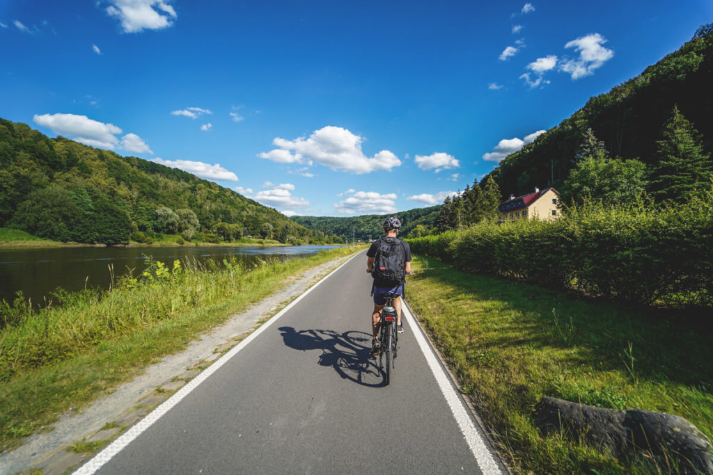
14. The Elbe Cycle Path
If you rent a bike, be sure to cycle directly along the Elbe. Here you can explore the region in a relaxed manner on the Elbe Cycle Path. This cycle path is one of the most popular cycle paths in Germany and is around 1,000 kilometers long (from Cuxhaven to the Czech Giant Mountains). And the best part: The most beautiful part of the cycle path leads through Saxon Switzerland. We had to stop and take photos constantly because the landscape just kept getting more and more beautiful. The route between Pirna and Königstein is highly recommended.
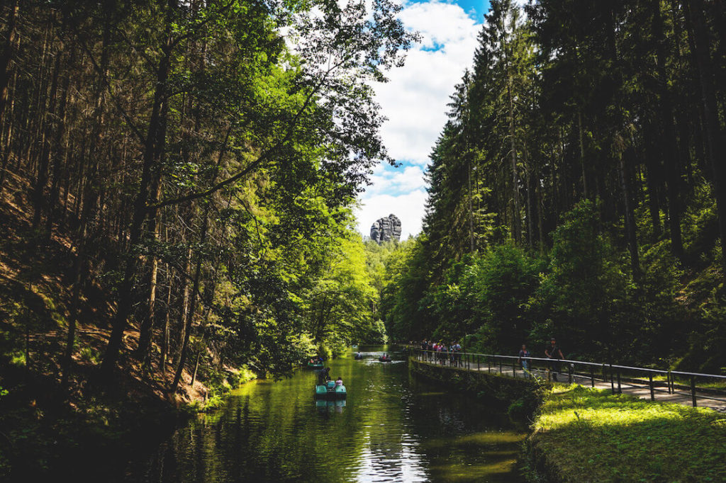
15. Upper Lock & Boat Trip
Let’s move on to the last highlight we’d like to introduce you to. On the first day of our trip, we took a trip to Hinterhermsdorf to take a boat trip on the Upper Lock. From the parking lot, we hiked for about two hours through the beautiful forest before reaching the dam, where the water plunged into the depths. Here we boarded the boat and enjoyed the approximately 700-meter-long boat trip to the boat station. The boat driver told us and showed us many interesting things.
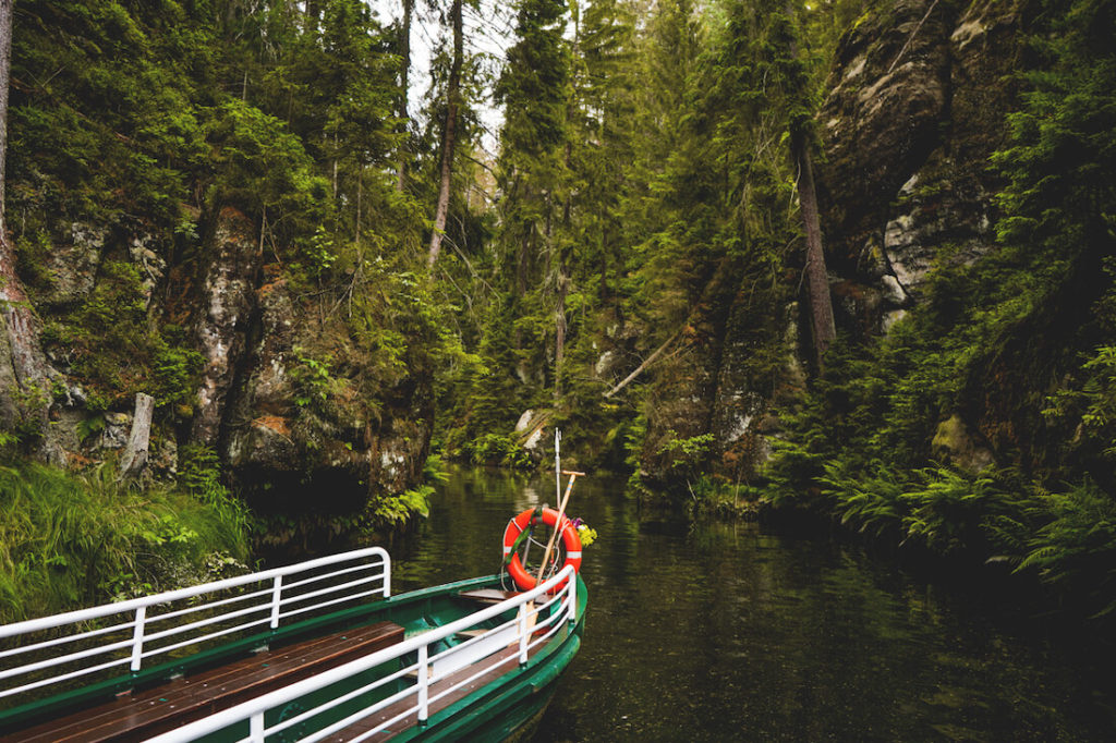
The boat trip leads through the romantic Kirnitzsch Gorge and is one of the top highlights in Saxon Switzerland. Most people start from the Buchenparkhalle parking lot and hike for 45 minutes to the boat station. We did it the other way around and were the only ones in the boat. It worked great and wasn’t a problem at all from the driver’s perspective. The one-way trip costs €7 per person. Opening hours: from Easter to October 31st, daily from 9:30 a.m. to 4 p.m. However, the times are currently subject to change (12 p.m. to 4 p.m.). Click here for our detailed travel report.
Conclusion on Saxon Switzerland
We haven’t seen all of Saxon Switzerland’s sights yet, that much is certain. Nevertheless, we really enjoyed this region and definitely want to come back and do more hikes and excursions. There’s so much to see and experience in this region; you could probably stay a whole year.
We highly recommend spending a few days in Saxon Switzerland; we’re still thrilled! Be prepared for a lot of visitors, though, as Saxon Switzerland is and remains an extremely popular holiday and hiking region in Germany. We found that the hiking trails were always well-spaced, except, of course, at the hotspots Bastei and Schwedenlöcher.
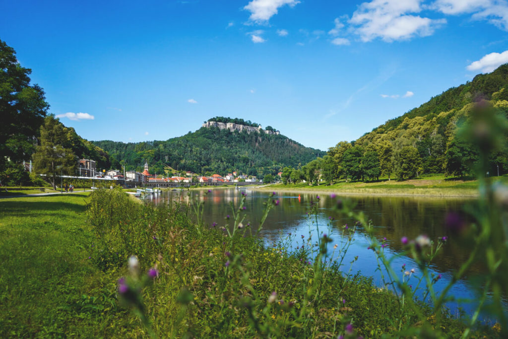
Camping Site Königstein
We stayed overnight at the Camping Site Königstein right on the Elbe River. This site is strategically perfectly located for exploring all the amazing sights of Saxon Switzerland. From there, we easily reached all directions. The campsite is neither too big nor too small; just right. From the site, you have a fantastic view of the Elbe River and the Königstein Fortress, which sits atop a hill above Königstein.
There’s a small shop, Wi-Fi, showers, toilets, a laundry room, parking, and two small camping areas, as well as pitches for caravans and trailers. We paid €8 per person, €6.50 for the tent, and €4 for the car per night. There was also a tourist tax of €1.20 per person per night. We can definitely recommend the site! By the way, the fresh rolls and croissants in the morning are delicious!
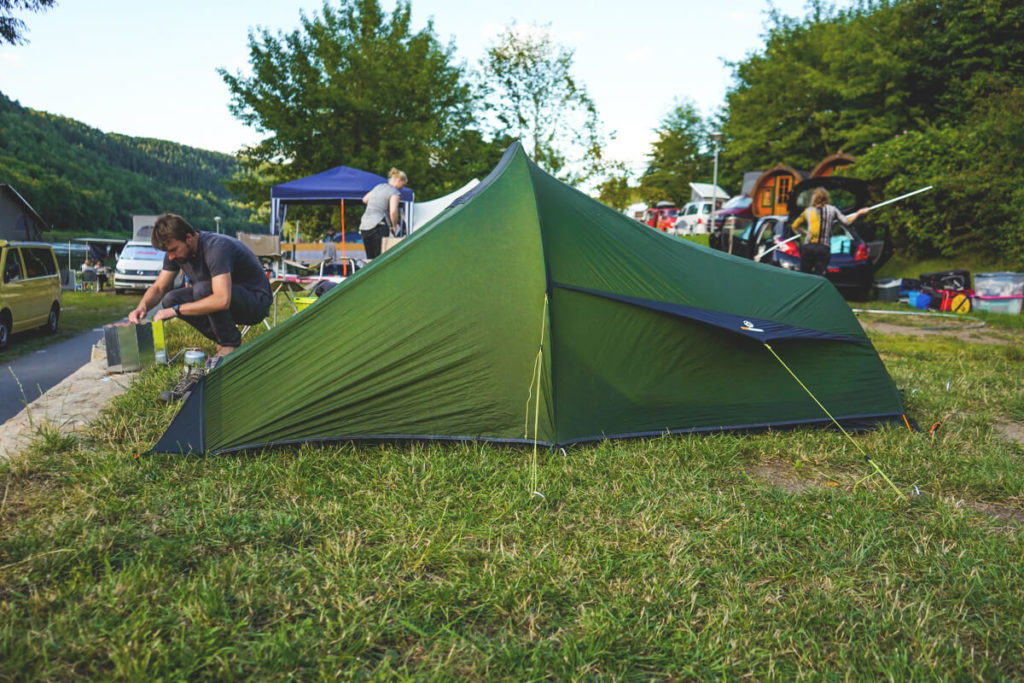
Our Camping Gear
For our camping trip in Saxon Switzerland, we brought our ultralight tent, our cozy sleeping bags, the small pillows, and the comfortable sleeping mats from Outdoorer, as always. We actually had almost everything we had with us on our trip to Iceland. Take a look at our packing list for Iceland. There you’ll find our complete camping gear, as well as our hiking clothing and other gadgets.
- Our ultralight tent with space for 2 people*
- Comfortable sleeping bags (up to 5°C), keep you very warm*
- Inflatable sleeping mats, we love them!*
- Camping stove for screw-in cartridges*
- LED lamp for our tent*
- Comfortable little pillows for sleeping comfort*
- Cooking set with pan, pot & Crockery*
- Super cool thermos flask for on the go*
Tip: The famous Malerweg
If you haven’t heard of the “Malerweg” yet, then you have. The Malerweg is approximately 112 kilometers long and is one of the most beautiful hiking trails in Germany. It is divided into 8 stages and leads through the entire Saxon Switzerland region. You will pass all the beautiful sights and places along the way. We chose stages 2 and 4 and slightly modified them. You can find everything about this hiking trail and the 8 stages here: Malerweg Sächsische Schweiz.