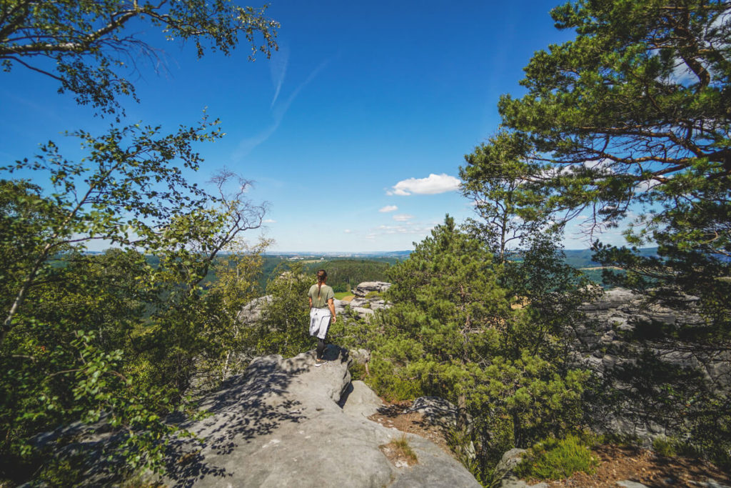
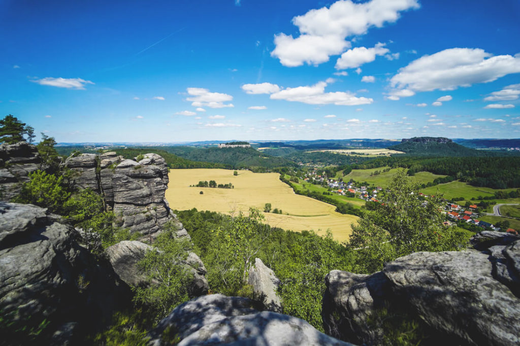
For us, the hike up the Pfaffenstein was definitely one of the top highlights of Saxon Switzerland. We cycled from Königstein to the starting point at the foot of the Pfaffenstein on our cool e-bikes. The views from the rocky plateau are outstanding; you can even spot the Königstein Fortress. The hike up the Pfaffenstein was strenuous, but worth the effort.
If you don’t have much time, you can take the strenuous route up the many steps and reach your destination in just 20 minutes. Do you have more time? Then we recommend a more extensive hike with a detour to the sacrificial cauldron and the striking “Barbarine” rock. You can find all the information about the hike in the following post. Enjoy browsing!
- Directions to Pfaffenstein
- Hikes in Pfaffenstein
- Highlights on Pfaffenstein
- Detour to the Hercules Pillars
- More impressions
Directions to Pfaffenstein
Our community recommended a hike up Pfaffenstein. No sooner said than done! We wanted to leave the car at home that day and go on an e-bike tour instead. Right next to our Königstein campsite, we discovered the tour operator “Kanu Aktiv Tours,” which rents out canoes, bicycles, and boats. For €30 per person, we organized two e-bikes for the day.

From Königstein, we drove along the Pfaffenberg roads to Pfaffendorf and continued straight ahead to the Pfaffensteinweg. From there, you can already see the high rocky plateau with its lush green forest all around. If you arrive by car, you can park it for a fee in Pfaffendorf (Pfaffendorf Hiking Car Park). From there, it’s about 400 meters to the starting point of your hike. We locked our e-bikes under a tree there.

No bike or car with you? Then you can also arrive by public transport. Take the S1 to Königstein and then change to bus no. 244a to Pfaffendorf. From there, continue on foot to the Pfaffenstein Trail, where you can begin your hike.
Pfaffenstein Hikes
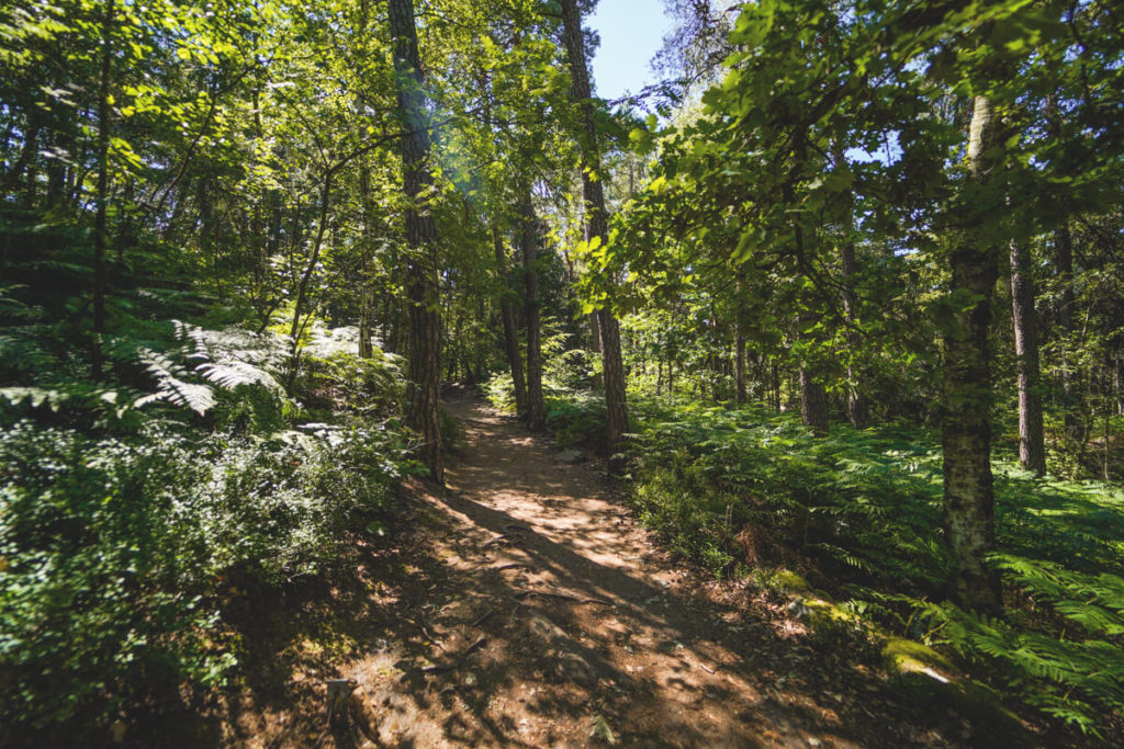
Now you have several options for a hike up the Pfaffenstein. You can take the “easy route” or the “strenuous route” through the “eye of the needle.” We wanted to take the easy route first, which leads right along the edge of the forest before turning left and then following the path that leads right past the Jäckelfels and the “small cowshed” to the rocky plateau. Depending on your pace, you’ll be up on the plateau in about 35 – 40 minutes. However, this path was closed due to forestry work, so we opted for the “strenuous route.”

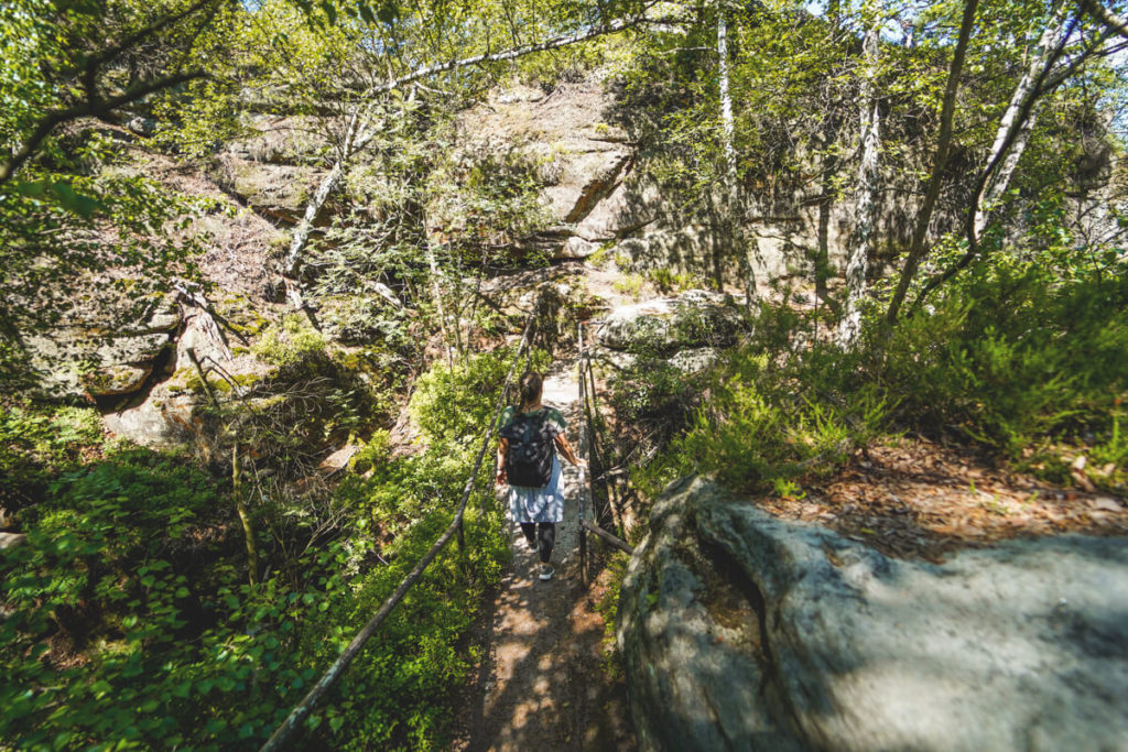
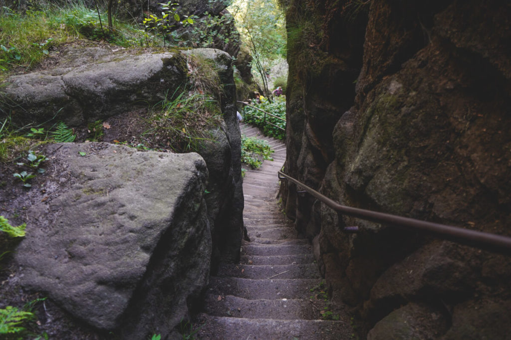
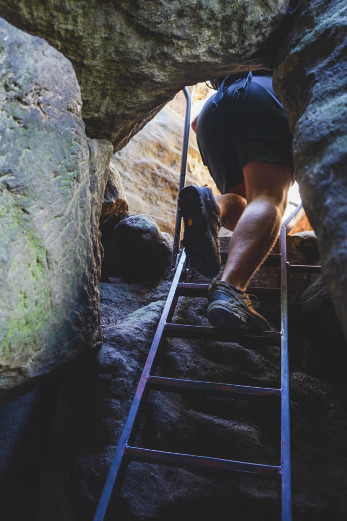
This starts right at the information board. You keep slightly to the left and climb the many steps. According to online information, there are more than 600 steps, but we didn’t count them. The path is short, but very strenuous. On this via ferrata, just before the finish, you’ll pass the so-called “Needle’s Eye,” a narrow hole in the rock that you traverse with the help of an iron ladder. You shouldn’t be claustrophobic here. But shortly afterward, you’ve almost reached the finish; only a few more steps remain until you reach the first beautiful viewpoints. The hike up the Pfaffenstein via the Nadelöhr takes just under 20 minutes.
A third hiking trail also starts at the information board and initially leads to the right along the edge of the forest (Pfaffenstein Circular Trail). After a few hundred meters, it continues towards Jäckelsfels. This time, however, it passes to the left and continues on the “Klammweg” to the top. According to former visitors, this is the most beautiful ascent. Stone steps, rocky alleys, narrow walkways, and stone benches await you on this trail. The hike takes around 35 to 45 minutes. Further down on the Komoot website, you’ll find various hiking options on the Pfaffenstein.
Highlights on the Pfaffenstein
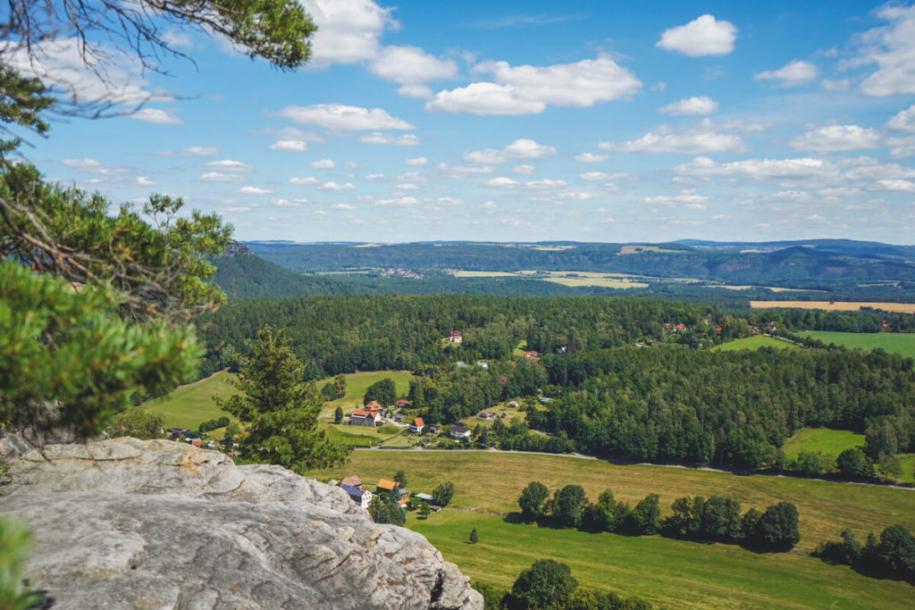
On the Pfaffenstein rock plateau, you’ll find not only beautiful views, but also several other highlights. We particularly enjoyed the view of the Gohrisch and Papststein mountains (immediately on the left after the eye of the needle), as well as the view as far as Königstein Fortress (right after the eye of the needle). On the main trail, you’ll reach the “Sacrificial Cauldron” (a cauldron-shaped depression from the last Ice Age) with a fantastic view.
If you have the time and inclination, you can continue hiking to the inn (check opening hours here) with its observation tower. Here, you can take a leisurely picnic break and rest your tired legs. From the inn, you can reach the striking and very famous “Barbarine” rock via the “Hohle Gasse” (Hollow Gasse). This rock is one of the landmarks of Saxon Switzerland. On the following page, you’ll find a detailed, drawn hiking map.
Detour to the Hercules Columns
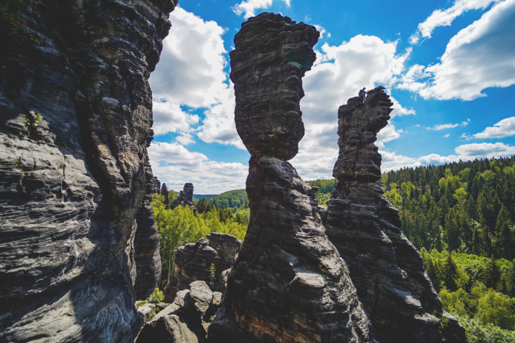
After the hike up Pfaffenstein, you can visit other highlights in the area, such as the Hercules Columns in the Bielatal Valley. We continued on our e-bikes along the beautiful valley road to the “Parkplatz am Johanniskegel” (a total distance of around 15km from Pfaffenstein). The Bielatal Valley is a climbing paradise with countless striking and bizarre rock towers.
From the parking lot, it’s only a few minutes’ walk to the Hercules Columns. If you have more time, you can take a circular hike (around 2 hours) with stops at various rock formations, viewpoints, deep holes, caves, and the Ottomühle mill. Possible hiking trails can be found here. There is an information board with marked hiking trails at the parking lot. It’s best to take a photo of these and then set off.
More impressions