What a fantastic Iceland tour! We truly had no idea that this country is so incredibly diverse and exciting. After exploring the north of Iceland, the east, and also the southeast, we now drove through Iceland’s south in our small rental car. Numerous spots, highlights, and sights awaited us again.
You could definitely spend years in Iceland discovering all of its beautiful places. New highlights hide around every corner; you’ll never stop being amazed. From Skaftafell National Park, we continued towards Vík. We’ll show you what we experienced here in the south in our article today.
Other important Iceland topics:
- Driving in Iceland
- Camping & Camping in Iceland
- Iceland’s Sights
- Currency in Iceland
- Best time to travel to Iceland
- Routes for 7 and 14 days
- Costs for our trip
- Our Iceland country page
- Preparing for Iceland
- The Vatnsnes Peninsula
- The North of Iceland
- The East of Iceland
- The Westman Islands
- The Southeast of Iceland
- Reykjavik Highlights & Tips
- The Golden Circle
- Other important Iceland topics:
- 1. Vík and the surrounding area
- 2. The DC-3 airplane wreck
- 3. The beautiful Seljalandsfoss
- 4. The mighty Skogafoss
- 5. Hikes in the Porsmörk Valley
- 6. Trip to the Westman Islands
- 7. The hidden Þjófafoss
- 8. Our little secret
- 9. Road 32
- South Iceland – All the Facts
- Conclusion on South Iceland
- Our travel diary on YouTube
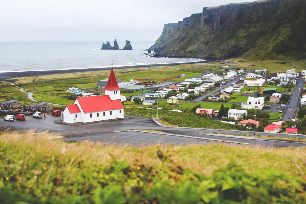
1. Vík and the surrounding area
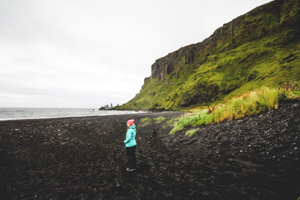
At the southern tip of Iceland lies the small village of Vík í Mýrdal. Although it is home to only around 300 inhabitants, the village still has a lot to offer. It is home to some of the most spectacular beaches in the world. The black beach is world-famous and can be reached via a short walk from Vík. Legend says that the bizarre rock formations of volcanic origin are petrified trolls. The church, perched on a hill, is particularly beautiful and makes a great photo opportunity. And if the Katla volcano erupts in the background, this hill will also be the first point of refuge in an evacuation.
Vik has a beautiful thermal bath, a café, a wool factory, a small shopping center, and restaurants. Most visitors, however, come to marvel at the nearby cliffs. These are prime spots for puffin watching. Reynisfjara Beach is world-famous and a wild yet dramatic place.
The crashing waves of the Atlantic crash onto the beautiful beach here, creating a stunning backdrop. Not far from this beach and Vík is the area around Cape Dyrhólaey. Here, too, you can observe the popular puffins and get up close to them. The various striking rocks are beautiful to look at, as is the dangerous-looking black beach.
2. The DC-3 Airplane Wreck
On November 21, 1973, a US Army DC-3 crashed on approach to Höfn. Radio contact was lost, and the fuel gauge never moved far from zero. The nightmare of every pilot and passenger. They decided on an emergency landing on the beach at Sólheimasandur. All crew members survived this maneuver – a blessing in disguise.
Today, all that remains on the beach are the skeleton and the remains of the aircraft. Eerily beautiful, yet tragic at the same time. Wind and weather, as well as the salty air and the fine sand, have all taken their toll on the wreck over the years. Much of it was dismantled and removed back then. However, the photo opportunity remains among the top 5 spots in Iceland to this day.
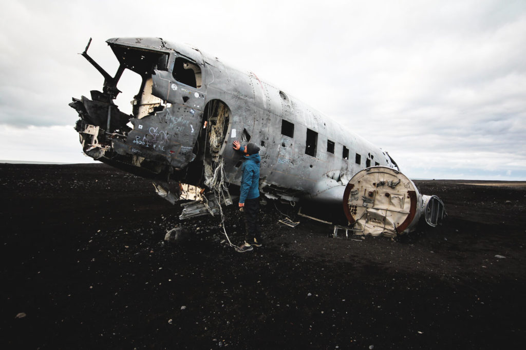
According to our own research, only around 16,000 DC-3 aircraft were built at the time. In Germany, this type is also known as the “Raisin Bomber.” This is how the airlift was primarily flown with this aircraft. Today, you can marvel at the wreckage and take great photos on the black beach. From the parking lot, a long path leads through the wilderness. There are no trees, bushes, or hills anywhere in sight. Plan at least 40 minutes for each route.
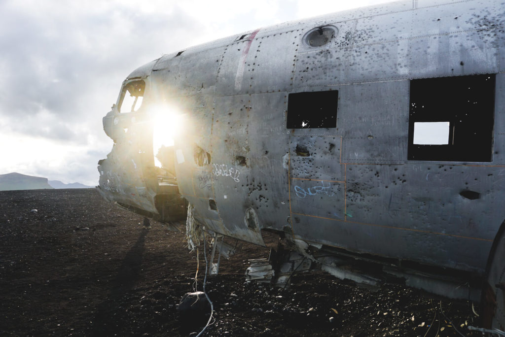
IMPORTANT: It is forbidden to climb onto the wreckage. Nevertheless, most tourists do so to take that photo. Please refrain. Serious accidents occur here again and again. This behavior will ultimately only lead to this “tourist attraction” being closed.
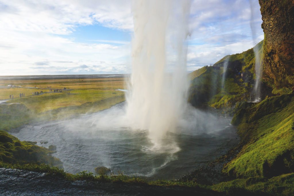
3. The beautiful Seljalandsfoss
Just a few meters from the Ring Road in the south of Iceland is the famous Seljalandsfoss. It is one of the most beautiful waterfalls in the country and is therefore very well visited. A trip to Iceland without Seljalandsfoss? Unthinkable! The waterfall plunges 66 meters from a high cliff into a small natural pool.
And what’s really crazy is that this cliff was once a seashore. But over the years, Iceland’s landmass has been raised more and more, so that the former cliff is now just a cliff edge. Here at the waterfall, there is also a campsite with a small cafeteria. Book your Iceland tour here*.
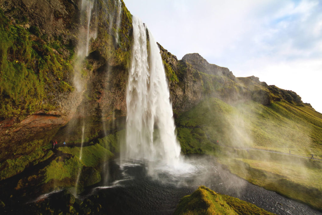
The special thing about this waterfall is the fact that you can walk behind it. Be sure to bring rain pants and a rain jacket, as it quickly gets damp and wet. It’s especially beautiful here at sunset, when the sky takes on beautiful colors.
A few meters from Seljalandsfoss, Gljúfurárfoss is hidden in a deep crevice behind a rock. You can either look into the cave from the cliff or go directly into the cave. But be careful! Depending on the water level, you might not get into the cave without getting your feet wet.
4. The mighty Skogafoss
You shouldn’t miss a detour to the Skogafoss Waterfall in the south of Iceland. The water plunges 60 meters from the steep edge into the depths. This edge was once the southern coastline of the country. Today, the sea is about 5 kilometers away. This part of the country was once covered in forest, hence the name Skógafoss, which means “forest waterfall.” The 25-meter-wide curtain of water is a beautiful sight. Enormous masses of water cascade right before your eyes. If you get too close, you’ll get wet. So be careful!

5. Hikes in the Porsmörk Valley
The Thorsmörk Valley is the most popular hiking area in Iceland. Unfortunately, we didn’t have the opportunity to do part of the hike. What a pity! But we’ll definitely make up for it on our next trip. The nature reserve is surrounded by volcanoes and glaciers on three sides. Trails to the Fimmvörðuháls volcano and the Eyjafjallajökull region await you.
The popular long-distance hiking trail, Laugavegur, starts from Skogafoss and leads inland. The hike takes several days/stages and takes you over the Fimmvörðuháls pass and the Þórsmörk to Landmannalaugar. The 22-kilometer route from Skogafoss to the Porsmörk Valley offers breathtaking scenery. So if you have enough time – DO IT!
Note: You can’t reach the Porsmörk Valley by car. You have to take the last stretch on an expensive bus, hitchhike, or have an SUV. However, you can easily start from Skogafoss. However, you have to keep in mind that your car is parked at Skogafoss, and you’ll have to somehow get back the entire 23 kilometers. Unfortunately, that was our problem, which is why we couldn’t do a day hike. If you’re doing several days, it’s certainly not a problem. More information about the hikes can be found here => www.outdooractive.com.
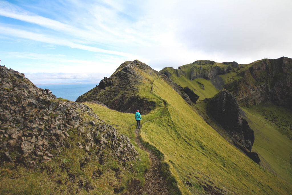
6. Excursion to the Westman Islands
Since we had plenty of time, we decided on a spontaneous excursion to the Westman Islands in the south of the country. We took the ferry from Landeyjahöfn to Heimaey. This island is also the only inhabited island in the archipelago off the south coast of Iceland. You only pay around €20 per person for the round trip. We stayed on the island in a super cool glamping cabin*. We went on a beautiful hike over the local mountain, Heimaklettur, saw puffins, and went to the thermal baths with locals. The island has a lot to offer and is definitely worth a visit. You can also just make a day trip or stay overnight.
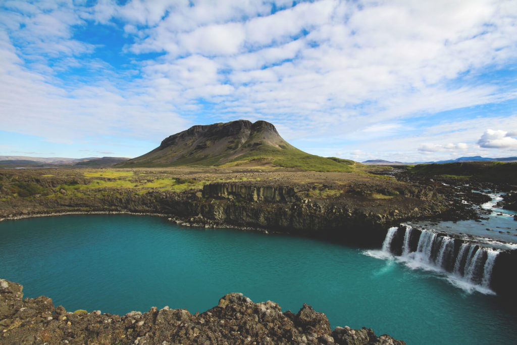
7. The Hidden Þjófafoss
On another day, we simply drove through the southern area and let ourselves drift. We discovered the beautiful Þjófafoss. It is located about 4 kilometers from Route 26. The scenery could hardly be more beautiful. Far in the background is the Hekla volcano, and in the foreground, another beautiful hill. The turquoise-blue glacial water cascades down the wide front and continues its way through the land. Only a young couple was with us at this waterfall. For Marco, it is one of the most beautiful locations in Iceland.
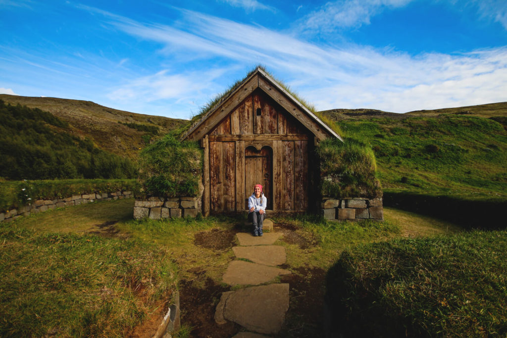
8. Our Little Secret
That day, by chance, we discovered a small house from Viking times in this region. Perhaps some of you will recognize it. For those who don’t: It will remain our secret! It was so beautifully quiet there, only a few visitors wandered in. These sod houses were built back then to withstand the changeable weather. Earth and stone were also used when no other materials were available. We’re keeping the location of this place to ourselves. You don’t always have to tell everything, right?
9. Road 32
As we continued on road 26 from Pjofafoss, we suddenly came to a gravel road. We chugged along for 10 kilometers at 10 km/h until we finally reached the end of the road. At the end, the road turns right onto the F26, which was off-limits to us. We turned left onto road 32. We actually wanted to go to the legendary Haifoss, which is accessible via road 332. After the gravel road on Route 26, however, we didn’t have the nerve for another one.
Haifoss is one of the highest waterfalls in Iceland and, according to Google, looks absolutely beautiful. Going in the other direction is the green, stunningly beautiful Gjain Valley with its smaller waterfalls. We would have loved to explore these spots. But we would have had to take Route 327, which was marked as an F-road and therefore off-limits to us. If you have an SUV, you could check out the spots.
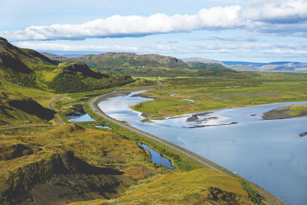
We continued south on Highway 32. At some point, we discovered a beautiful viewpoint. Unfortunately, we don’t know where exactly it is. Only by chance did we see the typical “Attention, here is a highlight” sign, which we followed. We climbed a short distance until we reached a small parking lot. We walked the remaining meters up the mountain. From the top, we had a magnificent view of the pretty valley. A little later on the 32, we also passed the pretty Hjalparfoss waterfall.
South Iceland – All the Facts
- Distance: – unpredictable
- Driving time: we spent 4 days in the south
- Camping: Vík, Svinafell, Skaftafell, Hella, Stokkseyri, Fludir Camping, Skogar Campsite, Hamragarðar, and many more.
- Larger supermarkets: Vík, Hella, Hvolsvöllur
- Fuel stations: Saudákrókur, Akureyri, Mývatn, Hvolsvöllur, Hella
- Camping card: Vík, Hella, Hvolsvöllur, Stokkseyri, and others
Conclusion on South Iceland
We really enjoyed our time in the south. You can see a lot in a very small space. You could spend many days in the entire southern region alone. In total, we spent almost 7 days in the south, southwest, and southeast. The diversity of the landscapes is simply overwhelming. From green hobbit-like landscapes to unique glacier and lava scenery.
We particularly enjoyed the detour on roads 26 and 32 with Þjófafoss, the small house, and the beautiful viewpoint. Of course, we also enjoyed Vík, the airplane wreck, and the waterfalls. If you want to know what awaits you in the southeast of the island, check out our article: Sights in Southeast Iceland. We can reveal this much in advance: The southeast is amazing!
Our travel diary on YouTube